The short answer. Mahé, the main island of Seychelles, packs 43 places worth a stop into an island about 27 km long. The essentials are Beau Vallon and Anse Intendance for beaches, Anse Soleil and the Ste Anne Marine Park for snorkelling, Copolia and Morne Blanc for views, and Victoria for the market, Clock Tower and Botanical Garden. Swim on the calm side of the island for the season: the north-west from May to October, the south and west from December to March.
This guide covers every place on Mahé we send guests to, by region, with time to allow, whether you can swim, the entrance fee, the Google rating and a local tip. 40 of the 43 have a rated Google listing, with 25,173 reviews between them. Fees match our Seychelles entrance fees page. Each place has a link to its Google reviews and to the tours that stop there.
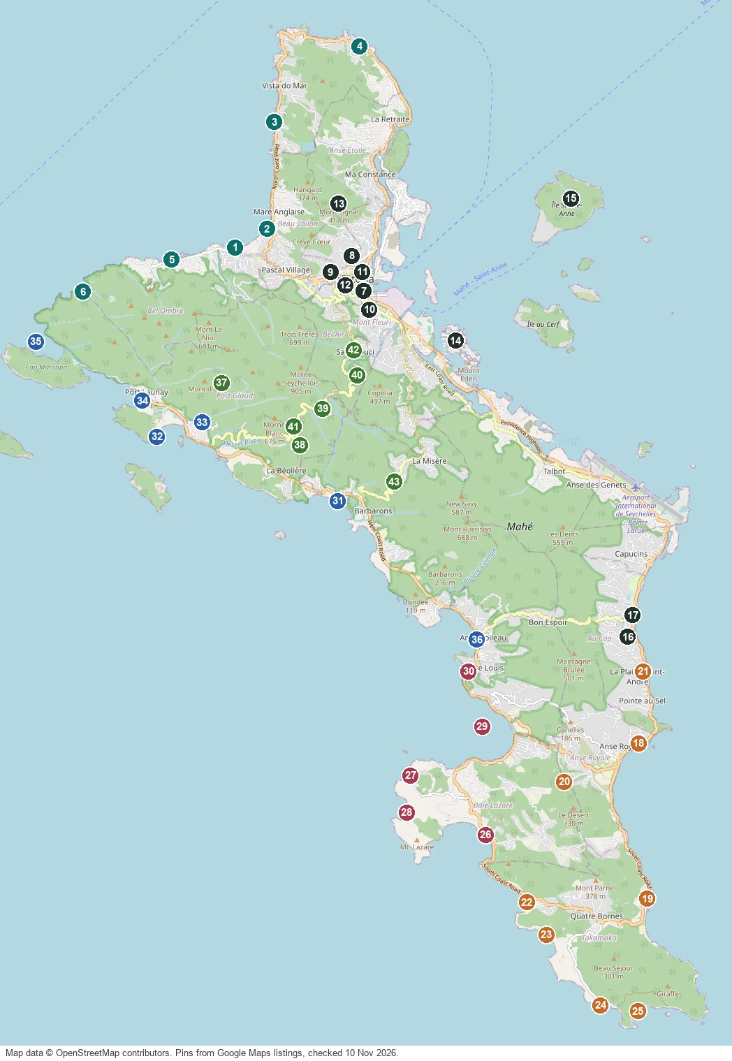
Map of the 43 places on Mahé
Best places on Mahé, by what you want
| Best for | Go to |
|---|---|
| Snorkelling | Anse Soleil · Port Launay · Sainte Anne Marine National Park · Baie Ternay Marine National Park |
| Children and shallow water | Anse Royale · Anse Forbans · Anse à la Mouche · Beau Vallon |
| Sunset | Anse à la Mouche · Sunset Beach · Anse Boileau · Anse Trusalo and L'Islette |
| Views | Copolia · Morne Blanc · Mission Lodge (Venn's Town) · Mont Signal viewpoint |
| Rainy day | National Museum of History · Takamaka Rum Distillery (La Plaine St André) · Sans Souci tea factory · Domaine de Val des Prés craft village |
| Look, never swim | Police Bay · Anse Bazarca · Carana Beach · Grand Anse (Mahé) |
| Free | Victoria and the Clock Tower · Sir Selwyn Selwyn-Clarke Market · Beau Vallon · Eden Island |
All 43 places at a glance
| # | Place | Area | Type | Swim | Entrance | |
|---|---|---|---|---|---|---|
| 1 | Beau Vallon | The north | Beach | Yes | Free | ★ 4.5 (1,168) |
| 2 | Bazar Labrin night market | The north | Street food market | – | Free entry, food paid in cash | – |
| 3 | Sunset Beach | The north | Small cove | Yes | Free | ★ 4.7 (318) |
| 4 | Carana Beach | The north | Photo stop | No | Free | ★ 4.6 (180) |
| 5 | Bel Ombre treasure site | The north | Historic site | – | Free to look from the road | – |
| 6 | Anse Major | The north | Beach reached on foot or by boat | Yes | Trail SCR 150 | ★ 4.6 (512) |
| 7 | Victoria and the Clock Tower | Victoria and the east coast | Capital city | – | Free | ★ 4.2 (1,469) |
| 8 | Sir Selwyn Selwyn-Clarke Market | Victoria and the east coast | Market | – | Free | ★ 4.0 (2,461) |
| 9 | Arul Mihu Navasakthi Vinayagar Temple | Victoria and the east coast | Temple | – | Free, donations welcome | ★ 4.4 (713) |
| 10 | National Botanical Garden | Victoria and the east coast | Garden | – | SCR 250 | ★ 4.2 (2,151) |
| 11 | National Museum of History | Victoria and the east coast | Museum | – | SCR 150 | ★ 4.5 (195) |
| 12 | Bel Air Cemetery | Victoria and the east coast | Historic cemetery | – | Free | ★ 4.1 (11) |
| 13 | Mont Signal viewpoint | Victoria and the east coast | Viewpoint | – | Free | – |
| 14 | Eden Island | Victoria and the east coast | Marina and restaurants | – | Free | ★ 4.5 (491) |
| 15 | Sainte Anne Marine National Park | Victoria and the east coast | Marine national park | Yes | SCR 200 | ★ 4.7 (651) |
| 16 | Domaine de Val des Prés craft village | Victoria and the east coast | Craft village and plantation house | – | Free | ★ 4.3 (660) |
| 17 | Kreol Institute (Lakademi Kreol) | Victoria and the east coast | Cultural institute | – | Free to visit the grounds | ★ 3.5 (8) |
| 18 | Anse Royale | The south | Reef beach | Yes | Free | ★ 4.6 (670) |
| 19 | Anse Forbans | The south | Quiet reef beach | Yes | Free | ★ 4.6 (102) |
| 20 | Le Jardin du Roi spice garden | The south | Spice garden | – | SCR 150 | ★ 4.2 (1,252) |
| 21 | Takamaka Rum Distillery (La Plaine St André) | The south | Rum distillery | – | Tour free, tasting SCR 150 | ★ 4.6 (2,529) |
| 22 | Anse Takamaka | The south | Beach | Seasonal | Free | ★ 4.6 (917) |
| 23 | Anse Intendance | The south | Wild surf beach | No | Free | ★ 4.7 (1,069) |
| 24 | Anse Bazarca | The south | Hidden cove | No | Free | ★ 4.9 (9) |
| 25 | Police Bay | The south | Viewpoint beach | No | Free | ★ 4.7 (431) |
| 26 | Baie Lazare | The southwest | Bay and village | Seasonal | Free | ★ 4.7 (464) |
| 27 | Anse Soleil | The southwest | Sheltered cove | Yes | Free | ★ 4.8 (612) |
| 28 | Petite Anse | The southwest | Beach | Seasonal | Free | ★ 4.7 (616) |
| 29 | Anse à la Mouche | The southwest | Shallow lagoon | Yes | Free | ★ 4.4 (107) |
| 30 | Anse Louis | The southwest | Bay | Yes | Free | ★ 4.6 (105) |
| 31 | Grand Anse (Mahé) | The west coast | Long wild beach | No | Free | ★ 4.5 (211) |
| 32 | Anse Trusalo and L'Islette | The west coast | Quiet beach and tidal islet | Yes | Free | ★ 4.3 (31) |
| 33 | Sauzier Waterfall | The west coast | Waterfall | Yes | SCR 50 | ★ 4.1 (678) |
| 34 | Port Launay | The west coast | Beach in a marine park | Yes | Free on the beach | ★ 4.6 (1,337) |
| 35 | Baie Ternay Marine National Park | The west coast | Marine national park | Yes | SCR 200 | ★ 4.7 (136) |
| 36 | Anse Boileau | The west coast | Village bay | Seasonal | Free | ★ 4.4 (149) |
| 37 | Morne Seychellois National Park | The mountains | National park | – | Trail fees SCR 100 to 250, age 12+ | ★ 4.7 (173) |
| 38 | Sans Souci tea factory | The mountains | Tea factory and viewpoint | – | Tour SCR 25 to 35 | ★ 4.0 (47) |
| 39 | Mission Lodge (Venn's Town) | The mountains | Viewpoint and ruins | – | SCR 100 | ★ 4.4 (355) |
| 40 | Copolia | The mountains | Short summit hike | – | SCR 100 | ★ 4.8 (938) |
| 41 | Morne Blanc | The mountains | Steep forest hike | – | No trail fee on the government list | ★ 4.8 (720) |
| 42 | Trois Frères | The mountains | Summit hike above Victoria | – | SCR 150 | ★ 4.4 (43) |
| 43 | Vallée des Fruits | The mountains | Organic fruit garden | – | Paid on site, or included on the airport tour | ★ 4.8 (484) |
The north: Beau Vallon and the coast road
Mahé's busiest beach, the evening market, two small coves and a bay with no road. In the north the sea is calm from May to October and rough from December to March.
1 Beau Vallon
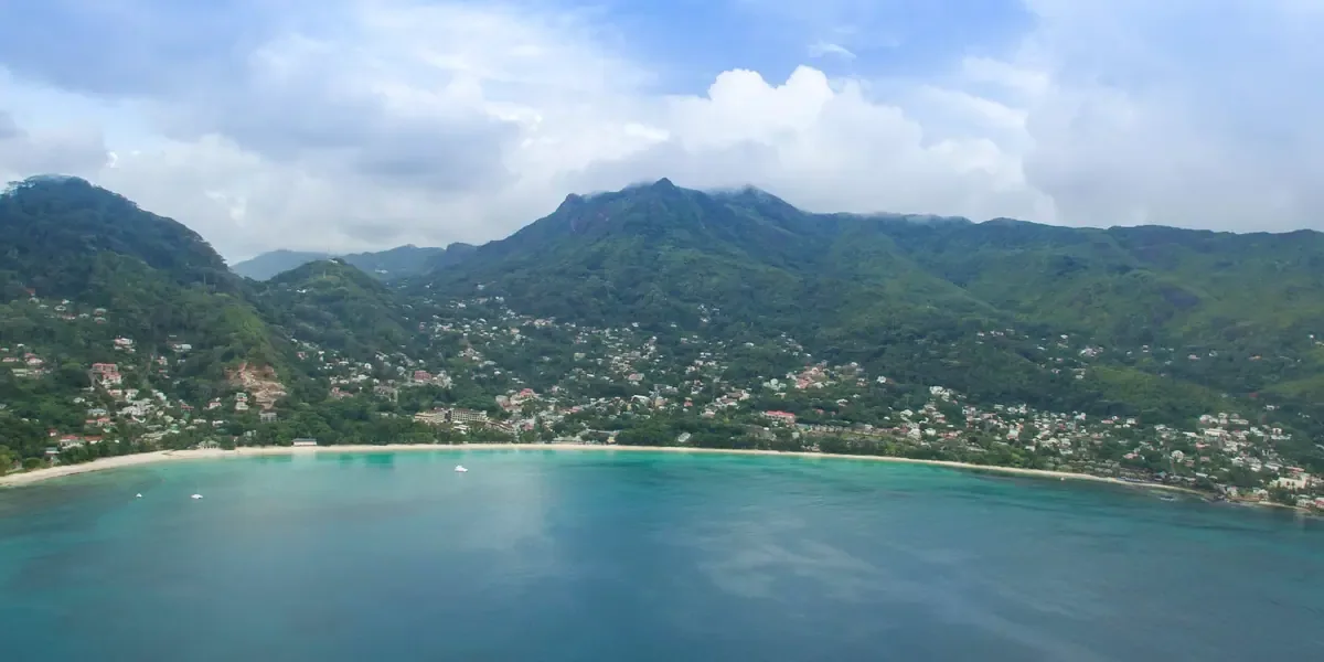
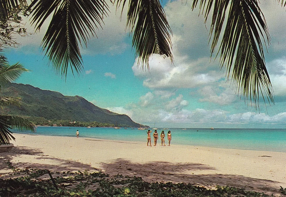
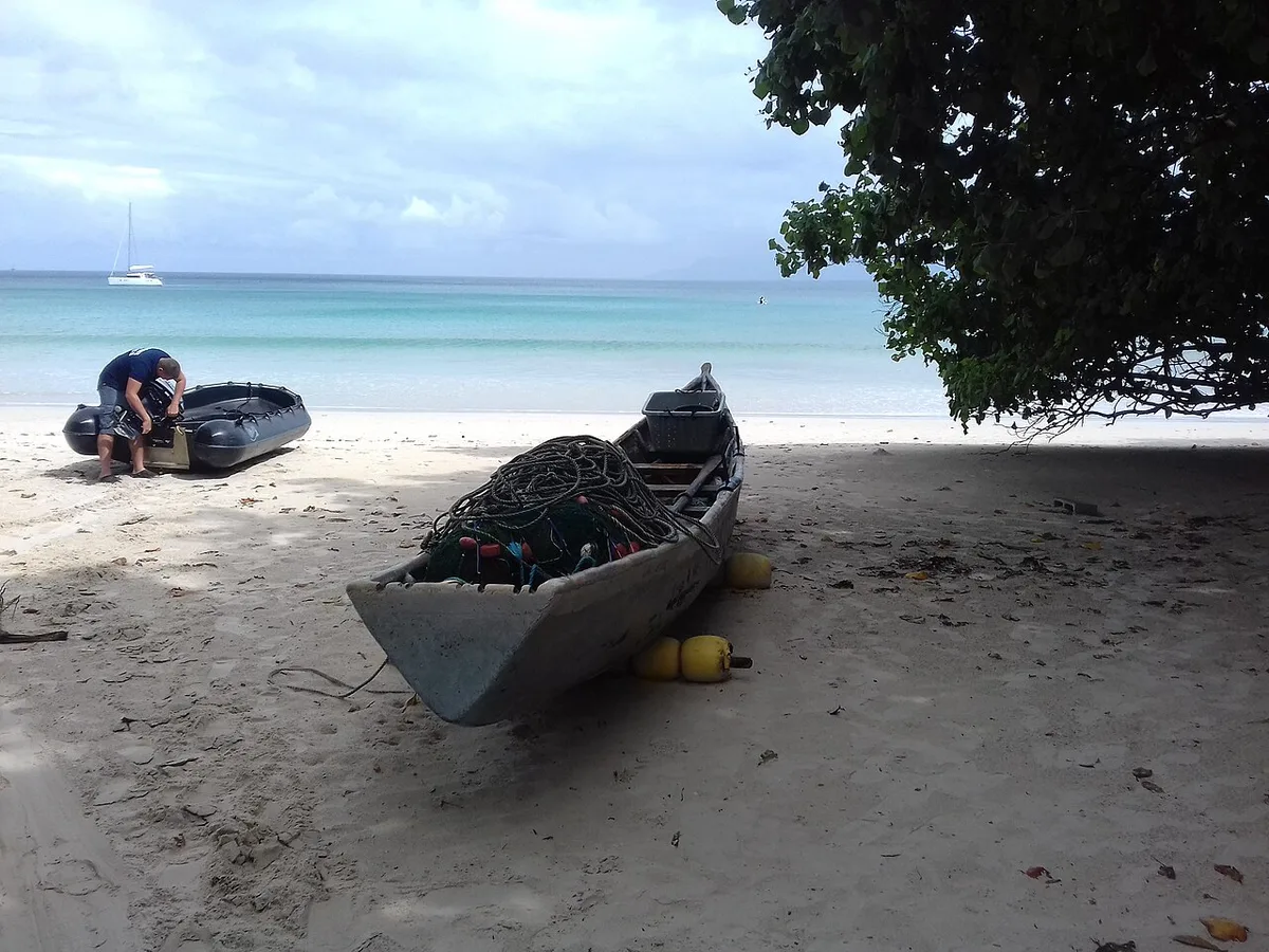
Beau Vallon is Mahé's best known beach: about 3 km of pale sand in a wide bay on the north-west coast, with hotels, restaurants, dive centres and water sports behind it. The sea is shallow and calm from May to October, when the south-east trade wind blows the other side of the island. From December to March the north-west wind brings swell here.
★ 4.5 from 1,168 Google reviews (checked 10 November 2026) · Read the Google reviews
- Type
- Beach
- Time to allow
- 1 to 3 hours
- Swimming
- Yes, shallow sandy entry. Calmest May to October
- Entrance
- Free
- Facing
- North-west
- Facilities
- Restaurants, toilets, sunbed hire, dive and snorkel centres
- Lifeguards
- Sometimes, not reliably
- Bus
- Frequent from Victoria
Local tip: Plan your beach by season. In the trade wind months the south is rough and Beau Vallon is like a pool. In the north-west monsoon swap them round.
Tours that stop here: Mahé island tour, private · Mahé beach tour, private · Soul Flower pareo workshop
Sources: Island Tour Seychelles, Wikipedia, Google Maps
GPS -4.6156, 55.4228 · Back to the map
2 Bazar Labrin night market
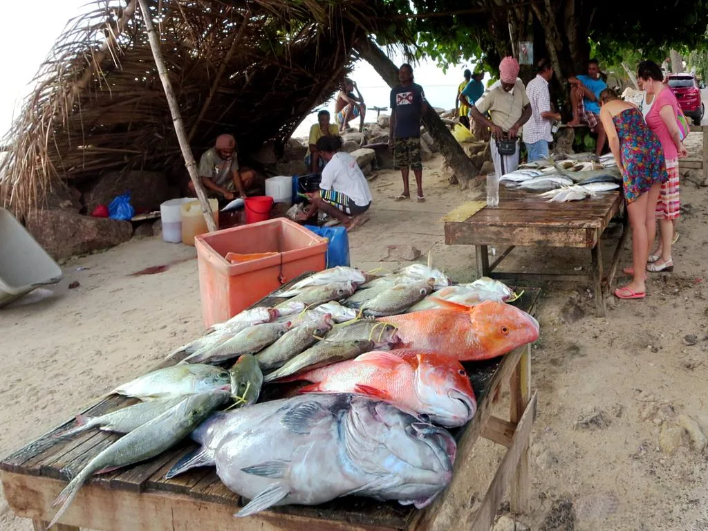
Bazar Labrin is the open-air evening market on the road behind Beau Vallon beach. Stalls sell grilled fish, Creole curries, octopus salad, fresh juice and cakes, with music as the sun goes down. It is the easiest way to eat like a local on Mahé. Wednesday evening is the main night. The local operator also reports a smaller market on Saturdays.
- Type
- Street food market
- Time to allow
- 1 to 2 hours, evening
- Entrance
- Free entry, food paid in cash
- When
- Wednesday from late afternoon, some Saturdays
- Where
- Beau Vallon, behind the beach
- Pay
- Cash, rupees
- Good for
- Dinner after a beach day, sunset
Local tip: Arrive before sunset for the best choice of fish, then walk down to the sand to eat.
Tours that stop here: Mahé night tour · Mahé beach tour, private
Sources: Island Tour Seychelles
GPS -4.6111, 55.4306 · Back to the map
3 Sunset Beach
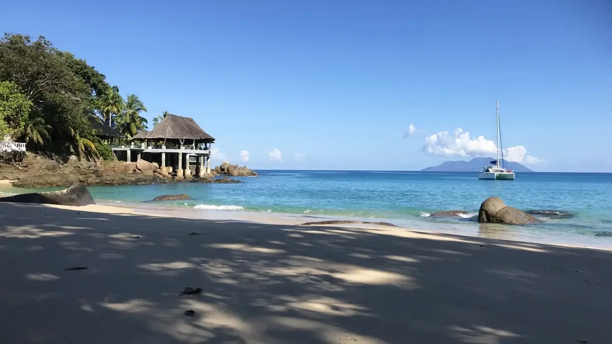
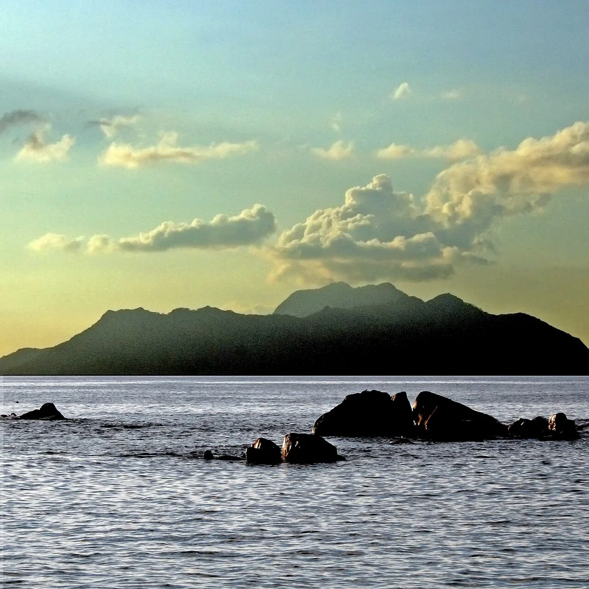
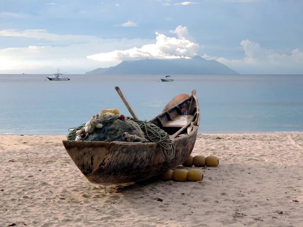
Sunset Beach is a small sandy cove between big granite boulders on the coast road north of Beau Vallon, next to the hotel of the same name. It faces west to Silhouette Island, which is where the sun goes down. In the calm season the water is still enough to snorkel along the rocks.
★ 4.7 from 318 Google reviews (checked 10 November 2026) · Read the Google reviews
- Type
- Small cove
- Time to allow
- 30 minutes to 1 hour
- Swimming
- Yes in calm weather, rocks for snorkelling
- Entrance
- Free
- Facing
- West, towards Silhouette
- Facilities
- None on the sand, bring water
- Access
- Path beside the hotel
Local tip: Keep this one for the end of the day. In December to March check the swell first.
Tours that stop here: Mahé beach tour, private
Sources: Island Tour Seychelles, Google Maps
GPS -4.5849, 55.4325 · Back to the map
4 Carana Beach

Carana Beach is a tiny cove in the far north of Mahé, beyond Glacis, framed by granite and leaning palms. It is one of the most photographed spots on the island, especially in late afternoon light. It is not a swimming beach: there is no reef, the cove opens to the north, and a current runs out between the rocks.
★ 4.6 from 180 Google reviews (checked 10 November 2026) · Read the Google reviews
- Type
- Photo stop
- Time to allow
- 10 to 20 minutes
- Swimming
- Not recommended: open to the north, outward current between the rocks
- Entrance
- Free
- Facing
- North
- Best light
- Late afternoon
- Access
- Short steep path from the coast road
Local tip: Take your photos here, then swim at Beau Vallon about 15 minutes to the south.
Tours that stop here: Mahé island tour, private · Mahé beach tour, private
Sources: Island Tour Seychelles, Google Maps
GPS -4.5664, 55.4534 · Back to the map
5 Bel Ombre treasure site
On the rocks at Bel Ombre, Reginald Cruise-Wilkins spent from 1949 until his death in 1977 digging for treasure said to have been hidden by the pirate Olivier Levasseur, known as La Buse, who was hanged in 1730. Nothing has been found. The dig site, marked on Google Maps as Treasure site, is a short stop on the way to Anse Major.
- Type
- Historic site
- Time to allow
- 15 minutes
- Entrance
- Free to look from the road
- Where
- Bel Ombre, coast road west of Beau Vallon
- History
- Levasseur's legend: a cryptogram and buried loot
- Dig
- From 1949, continued by the family after 1977
Local tip: Combine it with the Anse Major trail, which starts a few minutes further along at Danzilles.
Tours that stop here: Anse Major hike, private · Baie Ternay and Anse Major by boat
Sources: Wikipedia, Google Maps
GPS -4.6187, 55.4072 · Back to the map
6 Anse Major
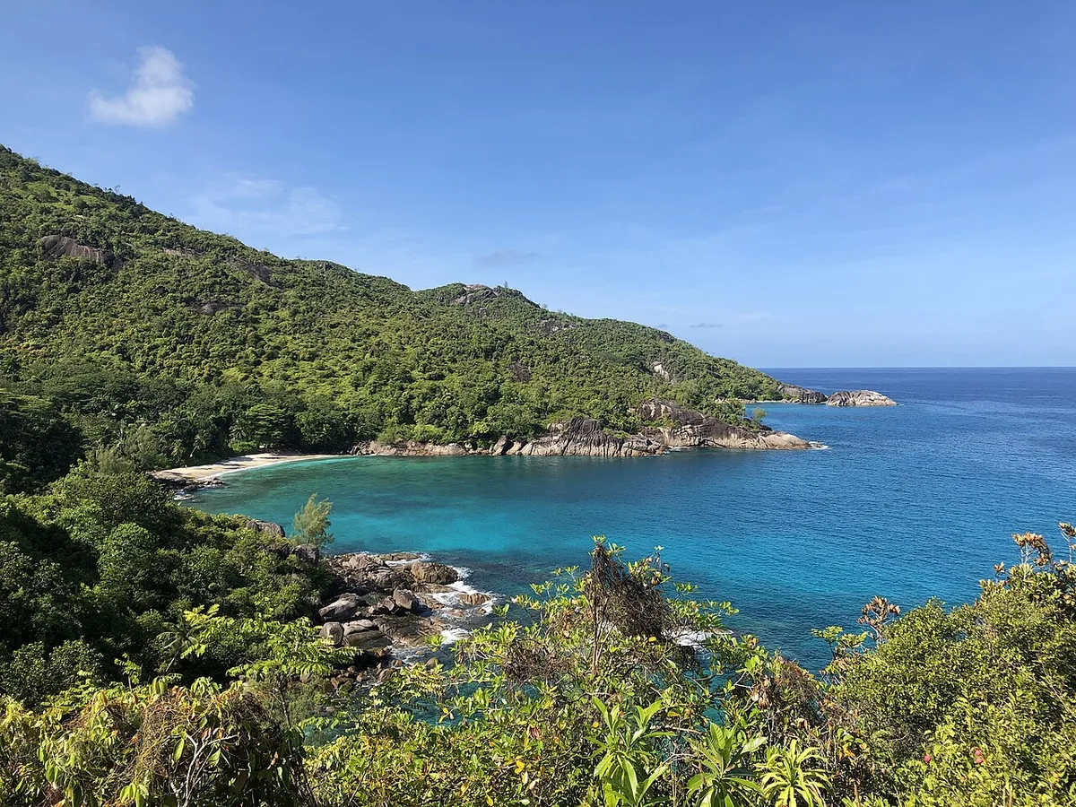
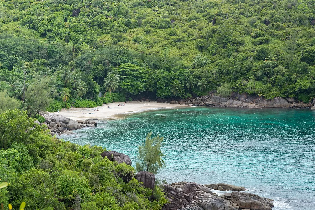
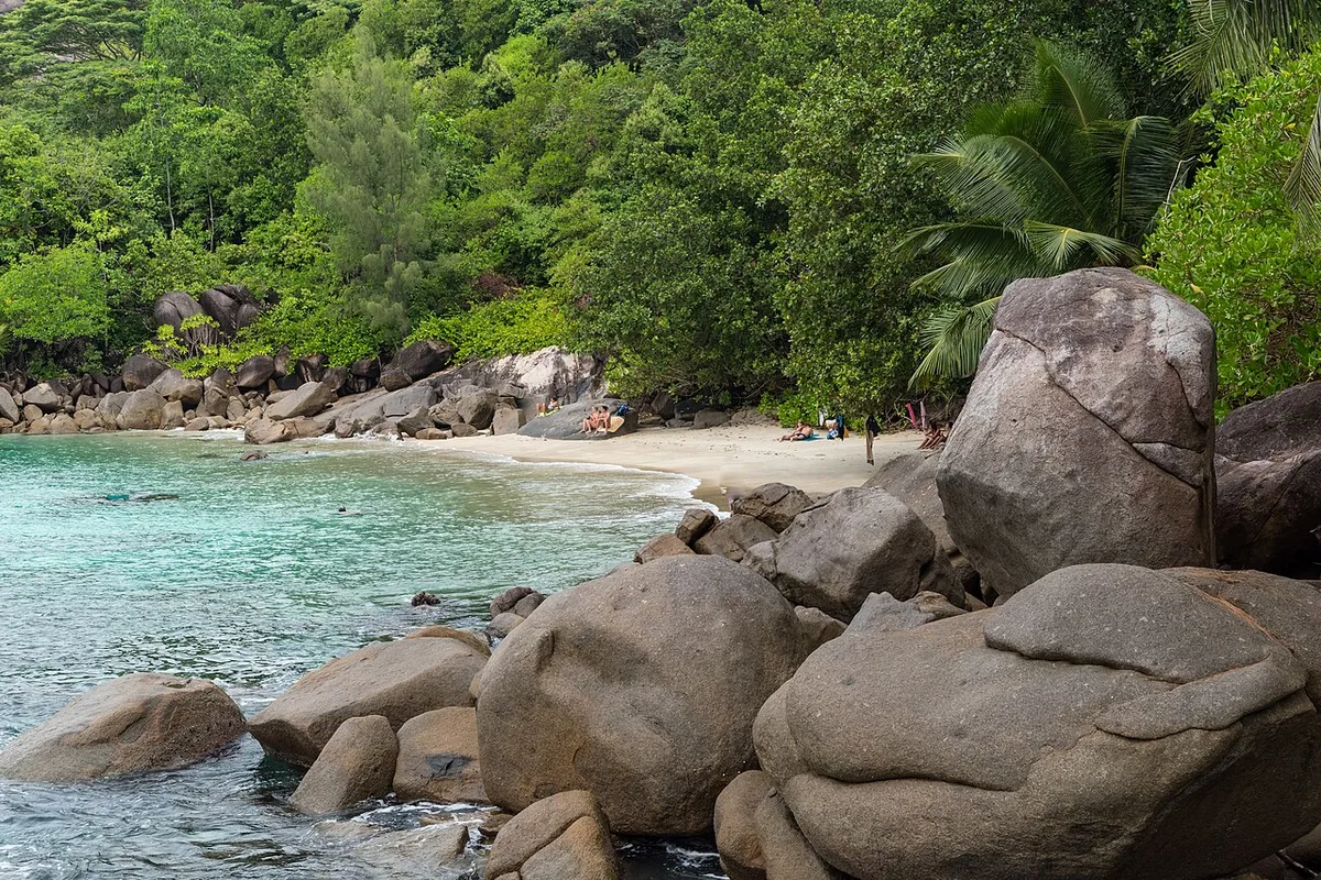
Anse Major is a small white-sand bay on the north-west coast that no road reaches. You walk in on a coastal trail from Danzilles near Bel Ombre, across bare granite with views over the sea, or arrive by boat. The trail is part of the national park, and government trail fees apply. Bring all your water: there is nothing to buy at the bay.
★ 4.6 from 512 Google reviews (checked 10 November 2026) · Read the Google reviews
- Type
- Beach reached on foot or by boat
- Time to allow
- Half day with the walk
- Swimming
- Yes in calm weather, no lifeguard
- Entrance
- Trail SCR 150 (about €9), age 12+
- Start
- Danzilles, end of the Bel Ombre road
- Walk
- About 1 hour each way, exposed and hot
- Facilities
- None
Local tip: Start before 9:00. The granite heats up fast and there is little shade on the way. All entrance fees.
Tours that stop here: Anse Major hike, private · Baie Ternay and Anse Major by boat
Sources: Island Tour Seychelles, Seychelles Parks and Gardens Authority, ticket list, SeyBooking.com entrance fees fact sheet
GPS -4.6265, 55.3854 · Back to the map
Victoria and the east coast
The capital fits in a few streets: market, clock tower, temple, museum and the Botanical Garden. Offshore lies the Ste Anne Marine Park. Further south are the craft village and the Creole Institute.
7 Victoria and the Clock Tower
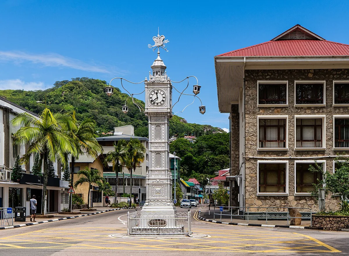
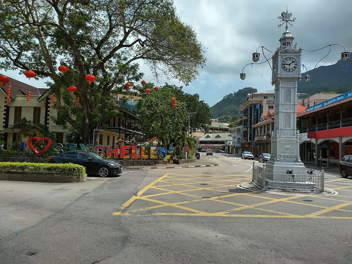
Victoria is one of the smallest capitals in the world, and you can see the centre on foot in an hour. Its landmark is the silver Clock Tower, Lorloz in Creole, put up in 1903 and modelled on a clock on Vauxhall Bridge Road in London. Around it, within a few hundred metres, are the market, the Hindu temple, two cathedrals and the National Museum of History.
★ 4.2 from 1,469 Google reviews (checked 10 November 2026) · Read the Google reviews
- Type
- Capital city
- Time to allow
- 1 to 3 hours on foot
- Entrance
- Free
- Landmark
- Clock Tower, 1903
- Walk
- Centre in about 1 hour
- Closed
- Most shops close early on Saturday and all day Sunday
Local tip: Go on a weekday morning, when the market is busy and the city is alive. The guided city walk does not run at weekends or on public holidays.
Tours that stop here: Victoria city walk, private · Mahé island tour, private
Sources: Island Tour Seychelles, Seychelles Tourism Board, Google Maps
GPS -4.6232, 55.4523 · Back to the map
8 Sir Selwyn Selwyn-Clarke Market

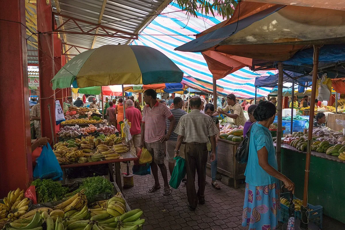
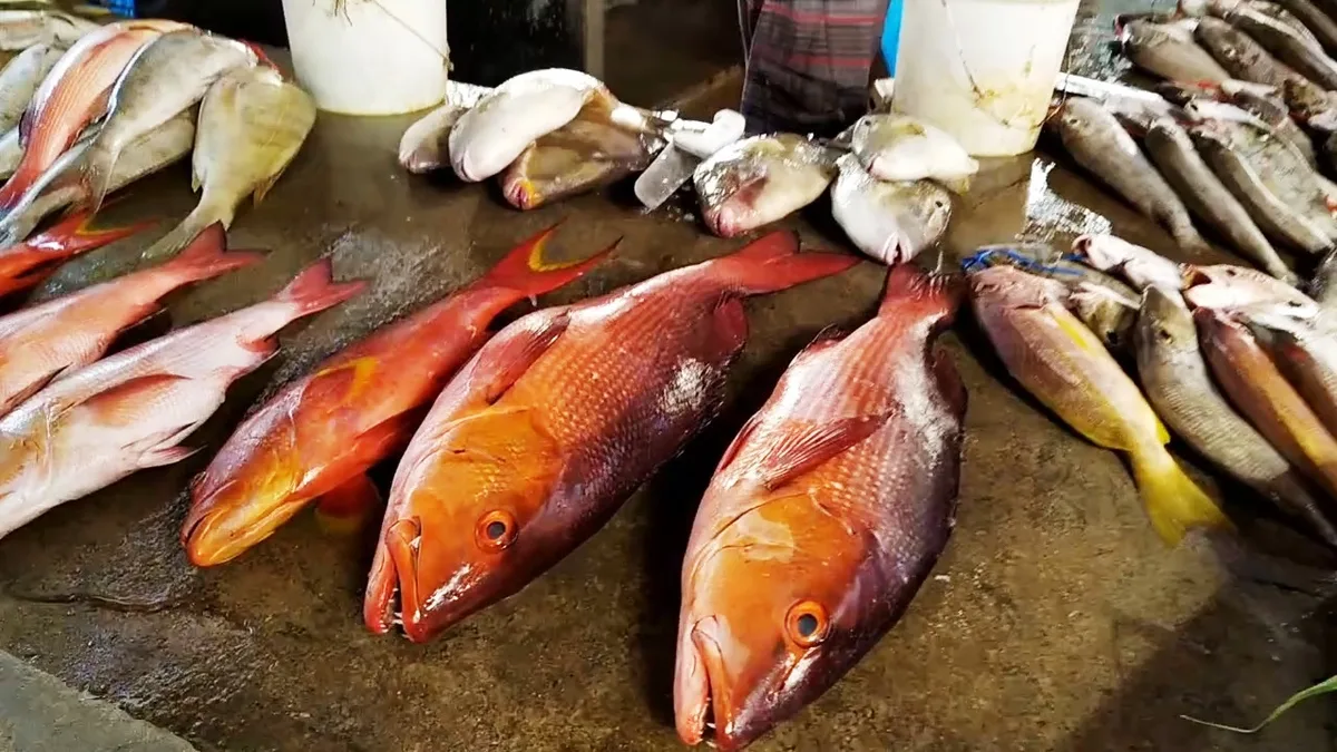
The Sir Selwyn Selwyn-Clarke Market on Market Street is where Victoria shops. Fish comes in at the front in the morning: tuna, bonito, grouper, parrotfish and octopus. Behind it are fruit, vegetables and chillies, then stalls with cinnamon, nutmeg, pepper and vanilla. Upstairs are fabrics, sarongs and souvenirs. It is busiest from 7:00 to 10:00, biggest on Saturday and closed on Sunday.
★ 4.0 from 2,461 Google reviews (checked 10 November 2026) · Read the Google reviews
- Type
- Market
- Time to allow
- 30 minutes to 1 hour
- Entrance
- Free
- Best time
- 7:00 to 10:00
- Closed
- Sunday
- Buy
- Vanilla pods and cinnamon travel well
- Haggling
- Friendly on spices, not on fish or vegetables
Local tip: Ask before you photograph a stall. Almost everyone says yes.
Tours that stop here: Victoria city walk, private · Mahé island tour, private
Sources: Island Tour Seychelles, Wikipedia, Google Maps
GPS -4.6213, 55.4513 · Back to the map
9 Arul Mihu Navasakthi Vinayagar Temple
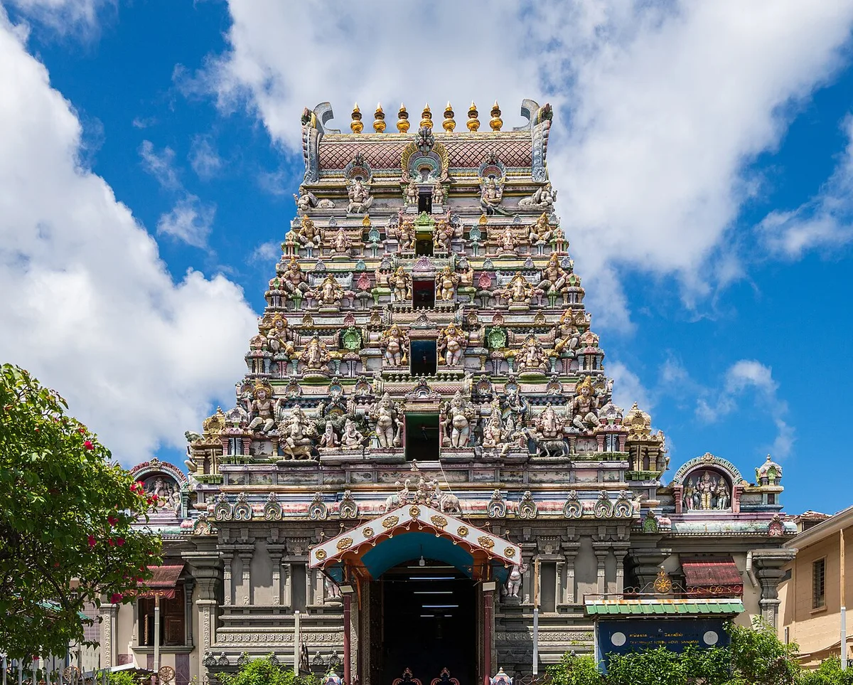
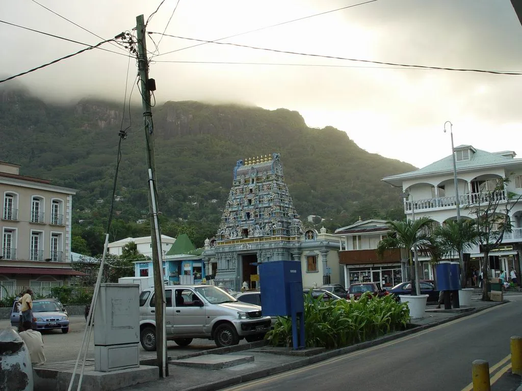
The Arul Mihu Navasakthi Vinayagar Temple on Quincy Street is the only Hindu temple in Victoria and its most colourful building, dedicated to Lord Vinayagar, also called Ganesh. Its tower is covered in painted figures of gods. Visitors may enter quietly outside prayer times, with shoulders and knees covered and shoes left at the door.
★ 4.4 from 713 Google reviews (checked 10 November 2026) · Read the Google reviews
- Type
- Temple
- Time to allow
- 15 to 20 minutes
- Entrance
- Free, donations welcome
- Where
- Quincy Street, a short walk from the market
- Dress
- Shoulders and knees covered, shoes off
- Photos
- Outside freely, inside ask first
Local tip: It sits two minutes from the market, so see both in one walk.
Tours that stop here: Victoria city walk, private
Sources: Seychelles Tourism Board, Google Maps
GPS -4.6215, 55.4503 · Back to the map
10 National Botanical Garden

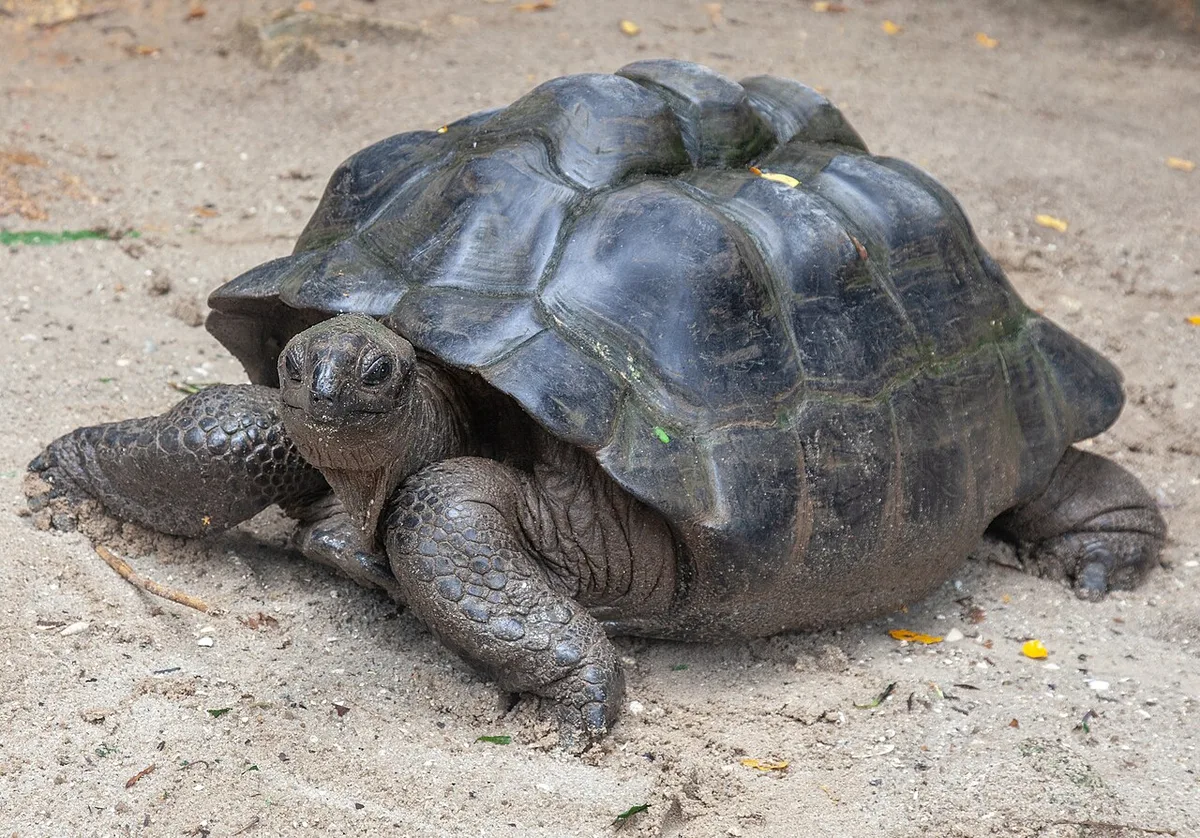

The National Botanical Garden on Mont Fleuri Road, on the south edge of Victoria, holds about 5 hectares of shade. Just past the entrance stand coco de mer palms, the giant double nut found wild only on Praslin and Curieuse. Further on are Aldabra giant tortoises, an orchid house, a spice corner, and fruit bats in the tall trees.
★ 4.2 from 2,151 Google reviews (checked 10 November 2026) · Read the Google reviews
- Type
- Garden
- Time to allow
- 1 to 1.5 hours
- Entrance
- SCR 250 (about €15), age 12+, card only
- Hours
- 8:00 to 17:00, last entry 16:30
- See
- Coco de mer, giant tortoises, orchids, fruit bats
Local tip: Morning is cooler and the tortoises are more active. The government takes card only on site, so do not rely on cash. All entrance fees.
Tours that stop here: Victoria city walk, private · Mahé island tour, private
Sources: Island Tour Seychelles, Seychelles Parks and Gardens Authority, ticket list, SeyBooking.com entrance fees fact sheet, Google Maps
GPS -4.6302, 55.4555 · Back to the map
11 National Museum of History

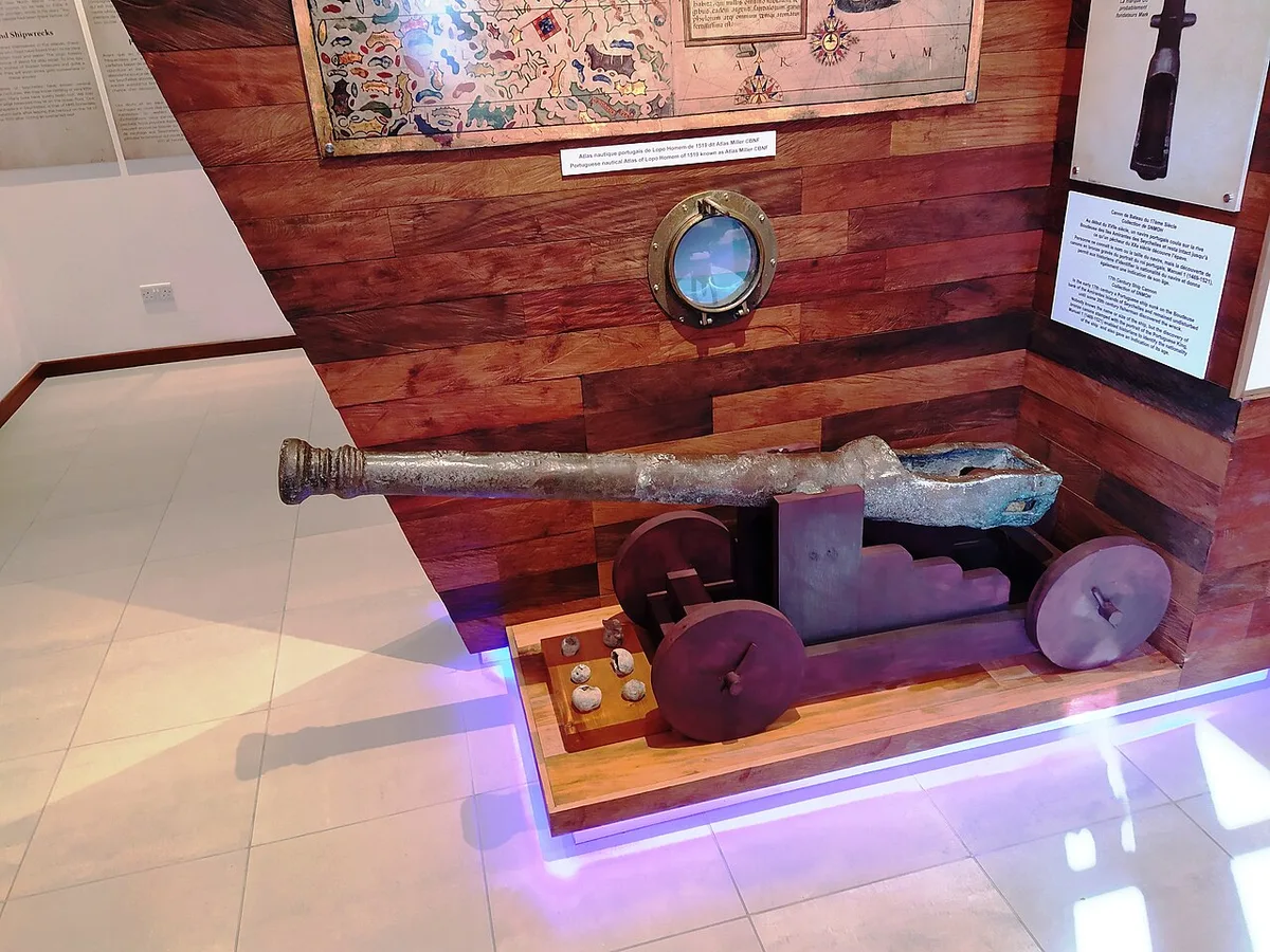
The National Museum of History on Independence Avenue tells the story of Seychelles from first sighting to independence in 1976. It is housed in the former Supreme Court building. Its best known object is the Stone of Possession, laid by the French in 1756 to claim the islands. Exhibits cover the slave trade, plantations, Creole life and the road to independence.
★ 4.5 from 195 Google reviews (checked 10 November 2026) · Read the Google reviews
- Type
- Museum
- Time to allow
- 45 minutes to 1 hour
- Entrance
- SCR 150 (about €9), under 12 free
- Where
- Independence Avenue, Victoria
- Pay
- Cash, Visa or Mastercard
Local tip: Do the museum before the market. It puts the city you are about to walk through into context. All entrance fees.
Tours that stop here: Victoria city walk, private
Sources: Seychelles Tourism Board, SeyBooking.com entrance fees fact sheet, Google Maps
GPS -4.6234, 55.4526 · Back to the map
12 Bel Air Cemetery
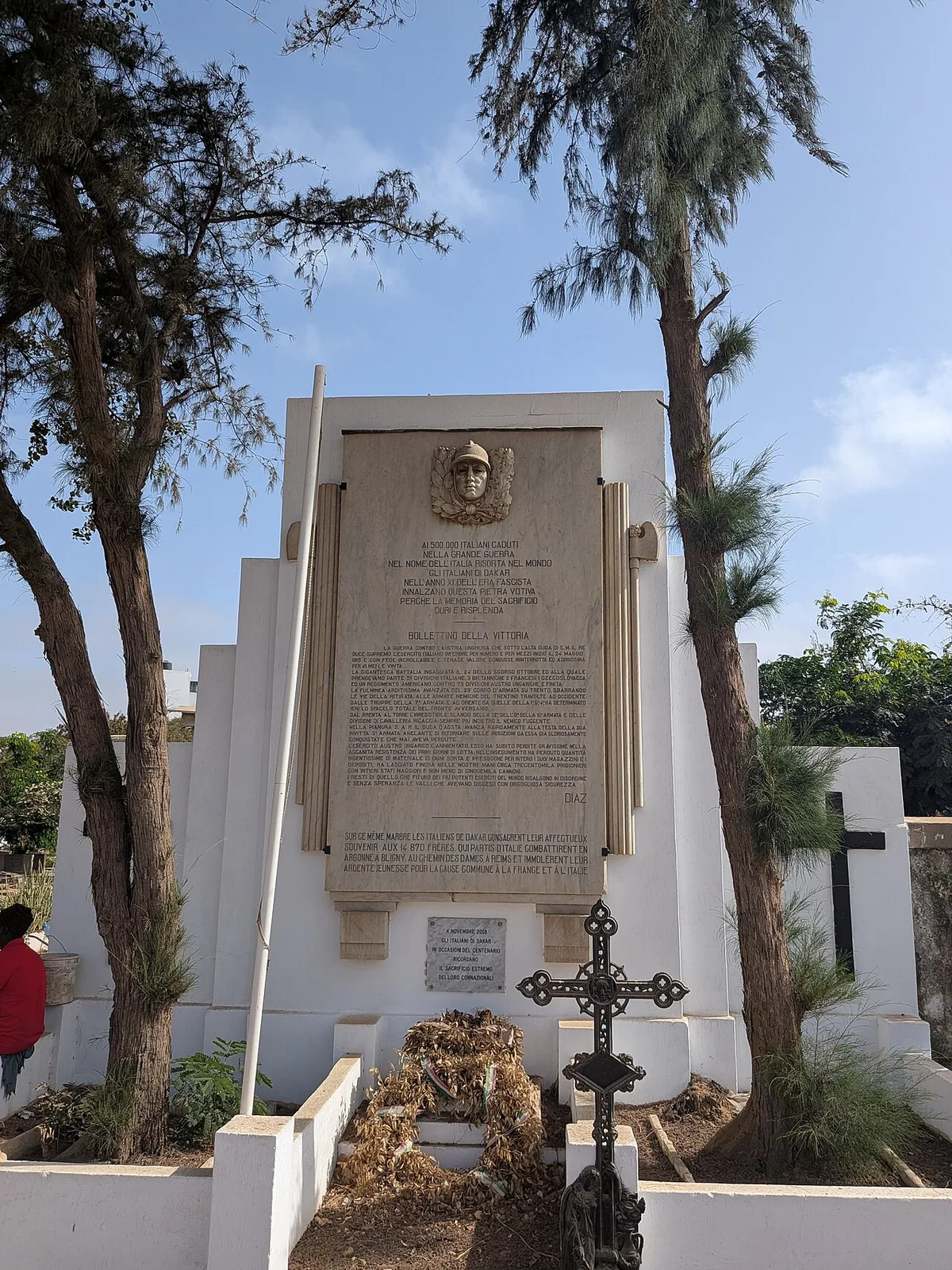
Bel Air Cemetery, on the Bel Air road climbing out of Victoria, is the oldest cemetery in Seychelles and the resting place of many of the first settlers. Local legend adds corsairs and a giant to the old graves. It is quiet and slightly overgrown, and a short stop for anyone interested in history.
★ 4.1 from 11 Google reviews (checked 10 November 2026) · Read the Google reviews
- Type
- Historic cemetery
- Time to allow
- 15 to 20 minutes
- Entrance
- Free
- Where
- Bel Air road, start of the Sans Souci crossing
- Status
- Historic site, still respected as a burial ground
Local tip: Stop on the way up to the Sans Souci road. Parking is tight, so a driver makes it easier.
Tours that stop here: Victoria city walk, private
Sources: Seychelles Tourism Board, Google Maps
GPS -4.6233, 55.4496 · Back to the map
13 Mont Signal viewpoint

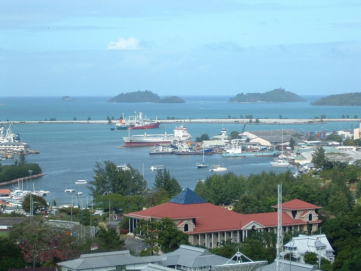
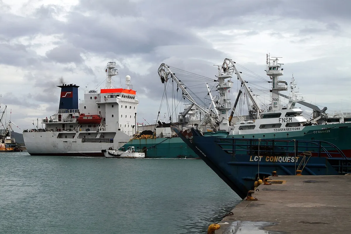
Mont Signal, also called Signal Hill, rises directly above Victoria. A short detour up the hill shows what the street never does: the capital squeezed between mountain and sea, the port with its tuna boats and freighters, Eden Island, and the islands of the Ste Anne Marine Park in pale, shallow water.
- Type
- Viewpoint
- Time to allow
- 10 to 20 minutes
- Entrance
- Free
- Best light
- Morning towards the islands, late afternoon over the city
- Skip it
- When cloud sits low on the hills
Local tip: Ten minutes is enough. Ask your guide to add it to the island tour.
Tours that stop here: Mahé island tour, private · Trois Frères hike, private
Sources: Island Tour Seychelles, Google Maps
GPS -4.6049, 55.4482 · Back to the map
14 Eden Island

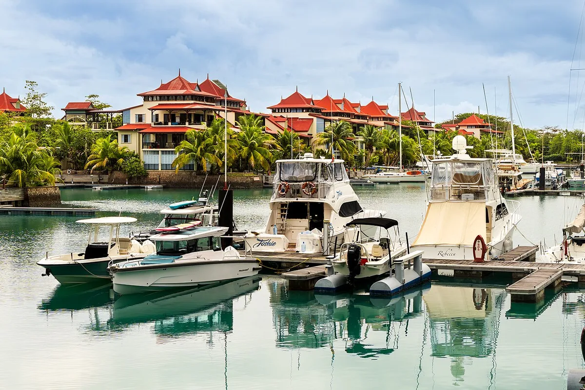
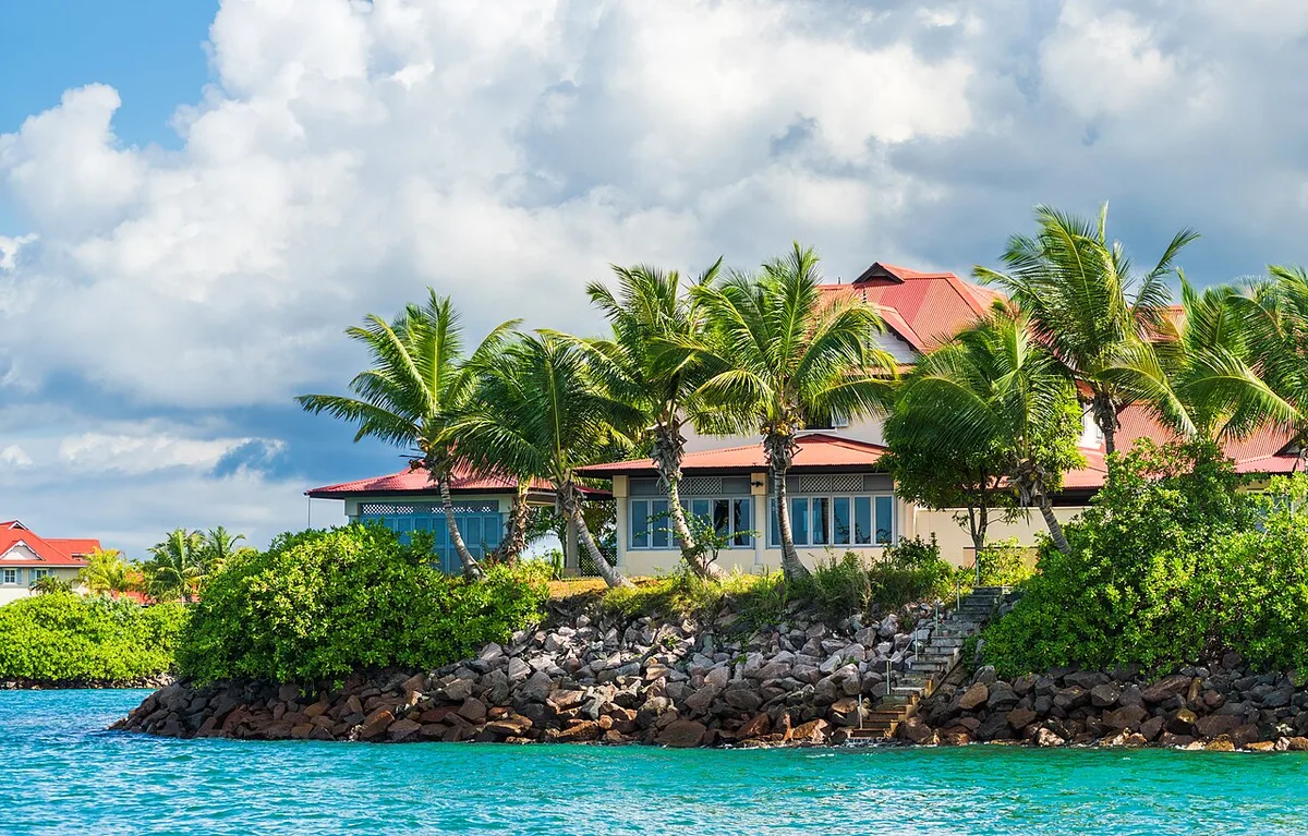
Eden Island is a residential island built on reclaimed land off Victoria and joined to Mahé by a bridge. It has a yacht marina, waterfront cafés and restaurants, shops and a large supermarket. From the marina edge you look back across the water to the mountains behind Victoria, one of the few places to see Mahé from the outside without a boat.
★ 4.5 from 491 Google reviews (checked 10 November 2026) · Read the Google reviews
- Type
- Marina and restaurants
- Time to allow
- 15 minutes to 1 hour
- Entrance
- Free
- Access
- By road over the bridge, bus from Victoria
- Facilities
- Restaurants, toilets, shops, supermarket
- Boats
- Some Ste Anne trips leave from here
Local tip: Good for a coffee stop or a shady lunch between Victoria and the east coast.
Tours that stop here: Mahé island tour, private · Ste Anne Marine Park private boat
Sources: Island Tour Seychelles, Google Maps
GPS -4.6385, 55.4769 · Back to the map
15 Sainte Anne Marine National Park

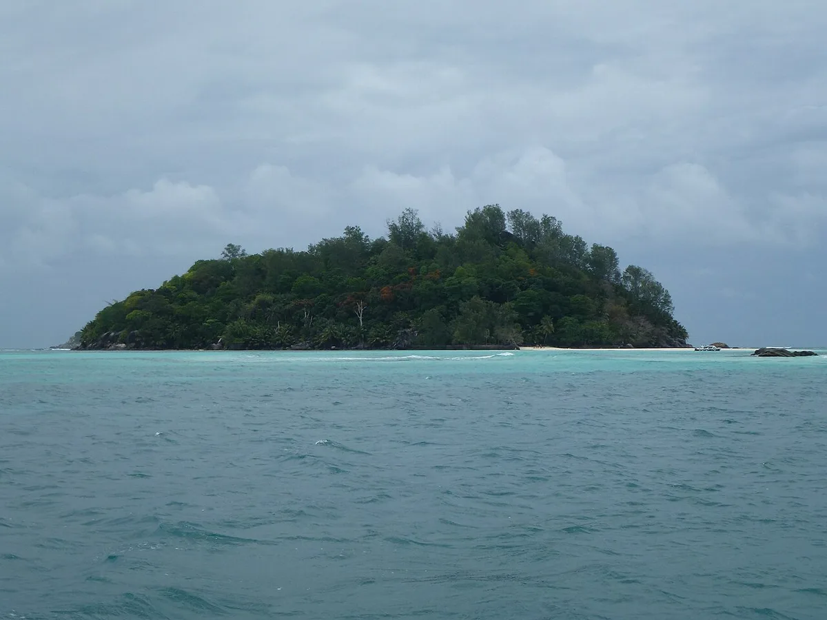

The Ste Anne Marine National Park lies about 5 km off Victoria: a group of small islands, including Ste Anne, Cerf, Round and Moyenne, set in shallow reef water. It was Seychelles' first marine national park. Glass-bottom boats, a semi-submarine and snorkelling trips visit daily. On Moyenne, Brendon Grimshaw lived almost alone from the 1960s until 2012 and planted thousands of trees.
★ 4.7 from 651 Google reviews (checked 10 November 2026) · Read the Google reviews
- Type
- Marine national park
- Time to allow
- Half day or full day by boat
- Swimming
- Yes, snorkelling over reef and seagrass
- Entrance
- SCR 200 (about €12), age 12+
- Hours
- 8:00 to 17:00
- See
- Turtles, rays, reef fish, giant tortoises on Moyenne
Local tip: Most trips include the park fee. Check before you pay so you are not charged twice. All entrance fees.
Tours that stop here: Ste Anne Marine Park private boat · Semi-submarine, Ste Anne
Sources: Seychelles Parks and Gardens Authority, ticket list, Wikipedia, SeyBooking.com entrance fees fact sheet, Google Maps
GPS -4.6037, 55.5053 · Back to the map
16 Domaine de Val des Prés craft village
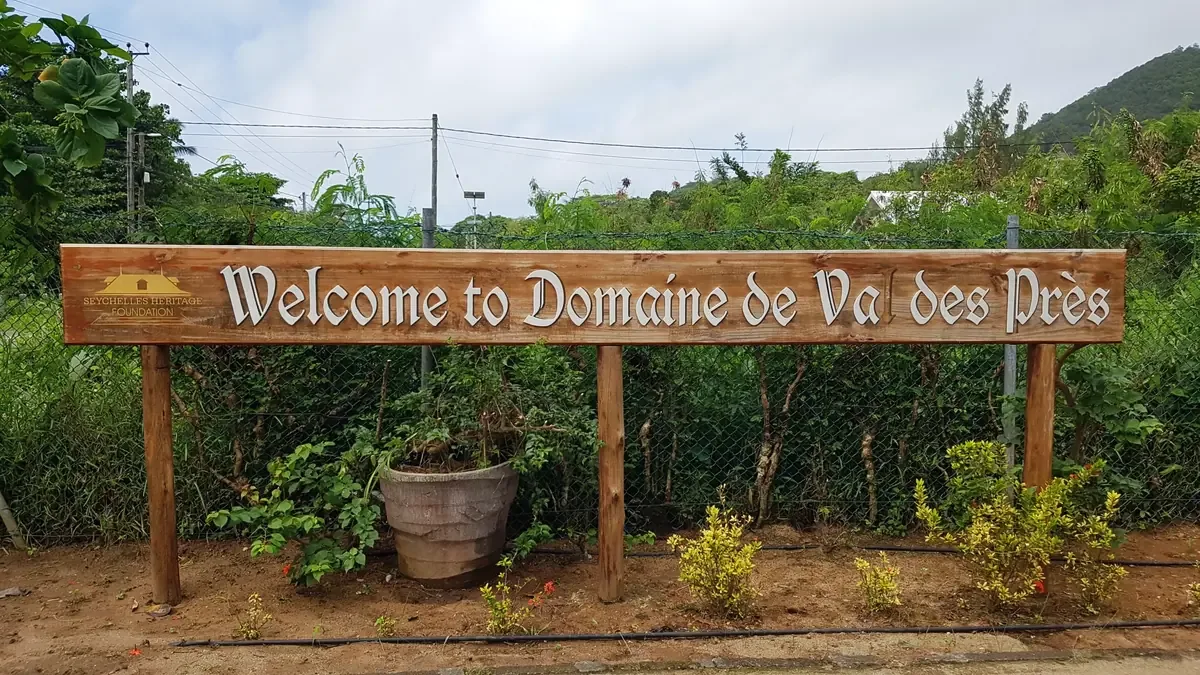
Domaine de Val des Prés, at Au Cap on the east coast, is a 19th-century plantation house surrounded by small craft workshops. You can watch makers polish coconut shell jewellery, carve wood, paint fabric and build model boats. The house is furnished as it was in plantation days, and a Creole restaurant sits in the garden.
★ 4.3 from 660 Google reviews (checked 10 November 2026) · Read the Google reviews
- Type
- Craft village and plantation house
- Time to allow
- 20 to 45 minutes
- Entrance
- Free
- Where
- Au Cap, east coast road
- Buy
- Handmade souvenirs, money stays on the island
- Food
- Creole restaurant in the garden
Local tip: Buy your souvenirs here rather than in town. You see who made them.
Tours that stop here: Mahé island tour, private
Sources: Island Tour Seychelles, Google Maps
GPS -4.7110, 55.5193 · Back to the map
17 Kreol Institute (Lakademi Kreol)
The Kreol Institute, Lenstiti Kreol, works to promote Seselwa Creole, one of the three national languages of Seychelles with English and French. It sits in Maison Saint-Joseph, a fine old wooden plantation house at Anse aux Pins, next to the craft village. Opening hours vary, and its Google rating is modest, so treat it as a short stop if you like architecture and language.
★ 3.5 from 8 Google reviews (checked 10 November 2026) · Read the Google reviews
- Type
- Cultural institute
- Time to allow
- 15 to 30 minutes
- Entrance
- Free to visit the grounds
- Where
- Anse aux Pins, near Domaine de Val des Prés
- Language
- Seselwa Creole, a national language since 1981
- Festival
- Creole Festival every October
Local tip: Combine with the craft village next door. Phone ahead if you want to see inside.
Tours that stop here: Mahé island tour, private
Sources: Wikipedia, Google Maps
GPS -4.7057, 55.5205 · Back to the map
The south: reef beaches, spices and rum
Shallow reef lagoons on the east side, open surf beaches on the south side, a spice garden and a rum distillery in a house from 1792.
18 Anse Royale
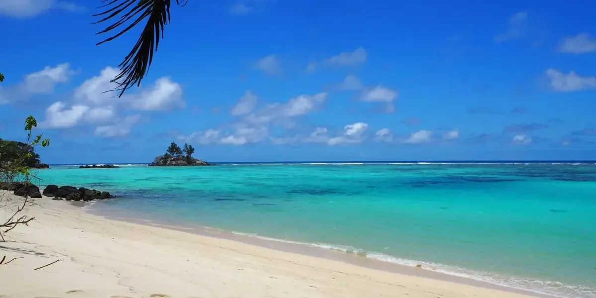
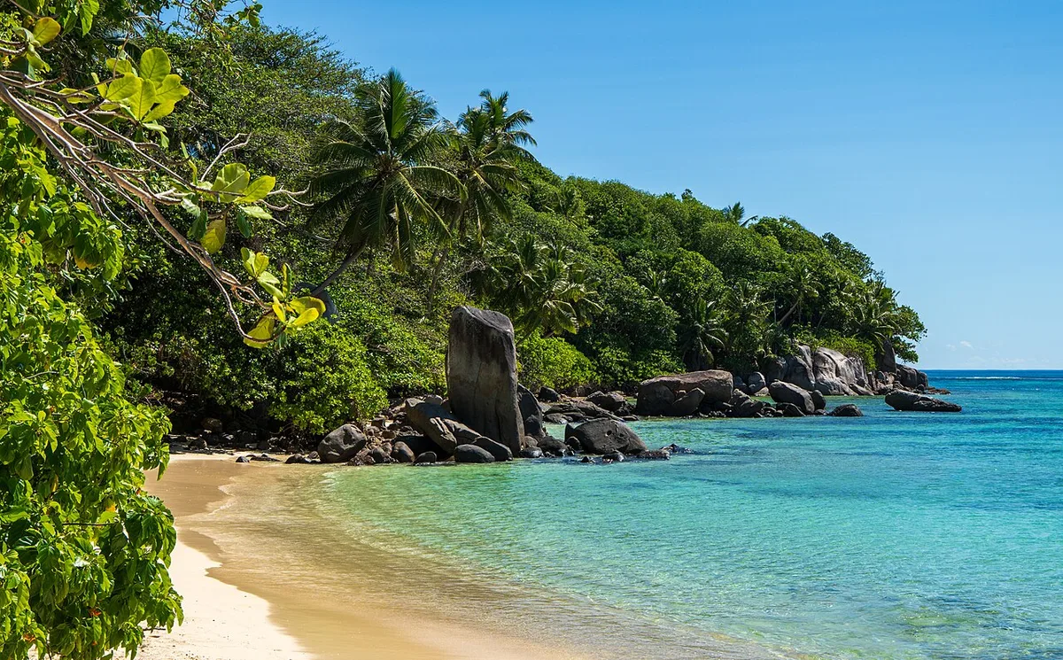
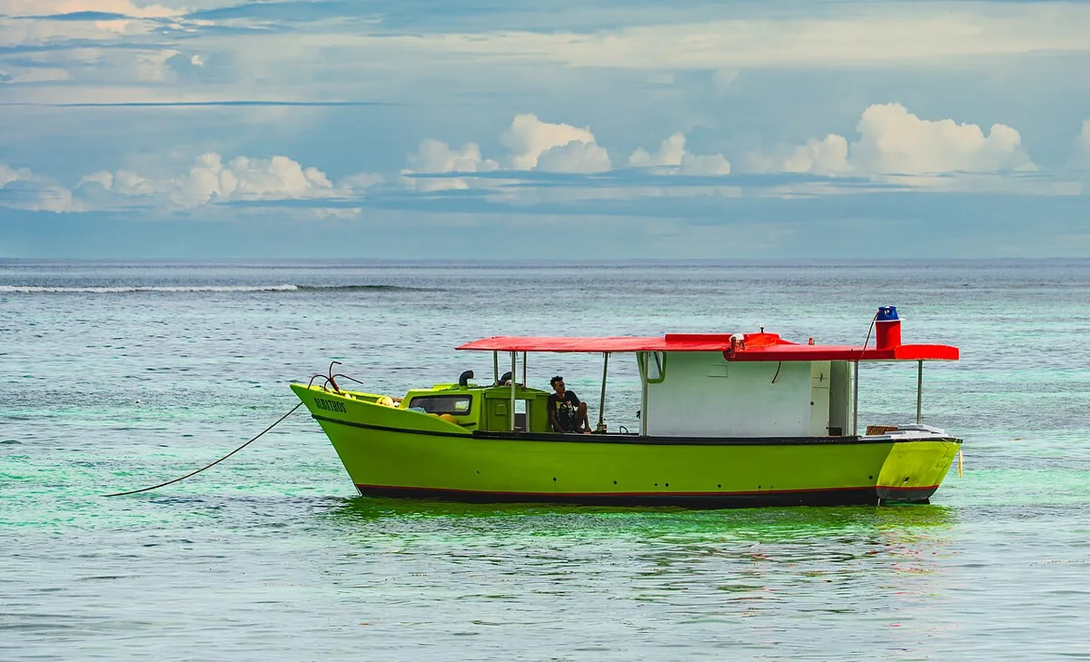
Anse Royale on the east coast is one of Mahé's calmest swimming beaches. A reef breaks the waves offshore, leaving flat, shallow water and granite boulders on pale sand, with the islet of Île Souris just off the beach. It is a real village too, with shops, snack bars and a petrol station along the road.
★ 4.6 from 670 Google reviews (checked 10 November 2026) · Read the Google reviews
- Type
- Reef beach
- Time to allow
- 1 to 2 hours
- Swimming
- Yes, sheltered behind the reef, snorkel at high tide
- Entrance
- Free
- Snorkel
- Best at high tide, very shallow at low tide
- Seagrass
- Washes up May to October, natural, not dirt
- Bus
- Frequent from Victoria
Local tip: Check the tide. At low tide you walk more than you swim, and you risk standing on coral.
Tours that stop here: Mahé island tour, private · Mahé beach tour, private
Sources: Island Tour Seychelles, Google Maps
GPS -4.7371, 55.5220 · Back to the map
19 Anse Forbans
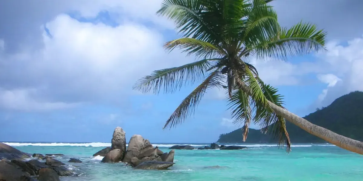
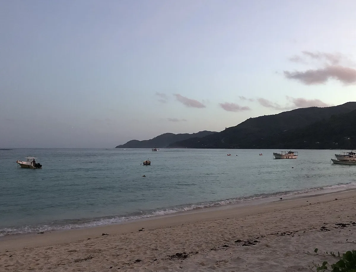
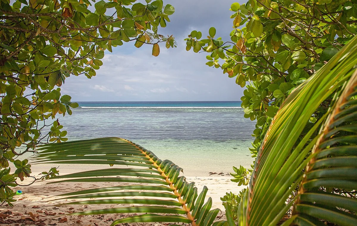
Anse Forbans, the bay of the privateers, lies on the south-east coast between Anse Royale and Takamaka. It is long, quiet and shaded by takamaka trees, with shallow water behind the reef that suits children. There are no sunbeds and no beach service, just a few guest houses and small restaurants along the road.
★ 4.6 from 102 Google reviews (checked 10 November 2026) · Read the Google reviews
- Type
- Quiet reef beach
- Time to allow
- 1 hour
- Swimming
- Yes, shallow and sheltered, good with children
- Entrance
- Free
- Name
- Forbans means privateers
- Facilities
- None on the sand, food along the road
- Seagrass
- Some May to September
Local tip: Choose it over Anse Royale when you want calm water without the village around you.
Tours that stop here: Mahé beach tour, private
Sources: Island Tour Seychelles, Google Maps
GPS -4.7751, 55.5241 · Back to the map
20 Le Jardin du Roi spice garden

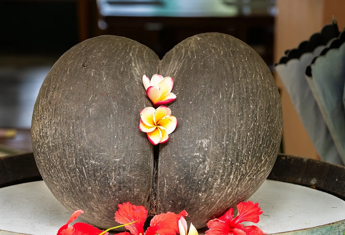
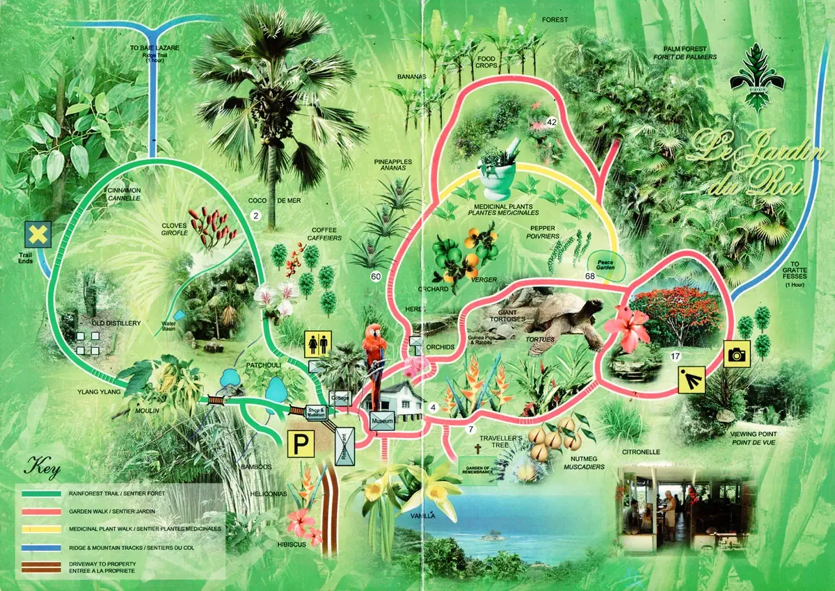
Le Jardin du Roi is a spice garden in the forest high above Anse Royale. A labelled path leads through cinnamon, nutmeg, vanilla, pepper and lemongrass growing on the slope. It takes its name from the French king's spice garden of the 1770s. An old plantation house holds a small museum, and the terrace restaurant looks over the bay and is known for its homemade ice cream.
★ 4.2 from 1,252 Google reviews (checked 10 November 2026) · Read the Google reviews
- Type
- Spice garden
- Time to allow
- 40 minutes, 1.5 hours with lunch
- Entrance
- SCR 150 (about €9)
- Pay
- Rupees or euros
- Food
- Creole lunch and ice cream on the terrace
Local tip: Time it for lunch. The road up is steep and long, so do not plan to walk it. All entrance fees.
Tours that stop here: Mahé island tour, private
Sources: Island Tour Seychelles, SeyBooking.com entrance fees fact sheet, Google Maps
GPS -4.7465, 55.5036 · Back to the map
21 Takamaka Rum Distillery (La Plaine St André)

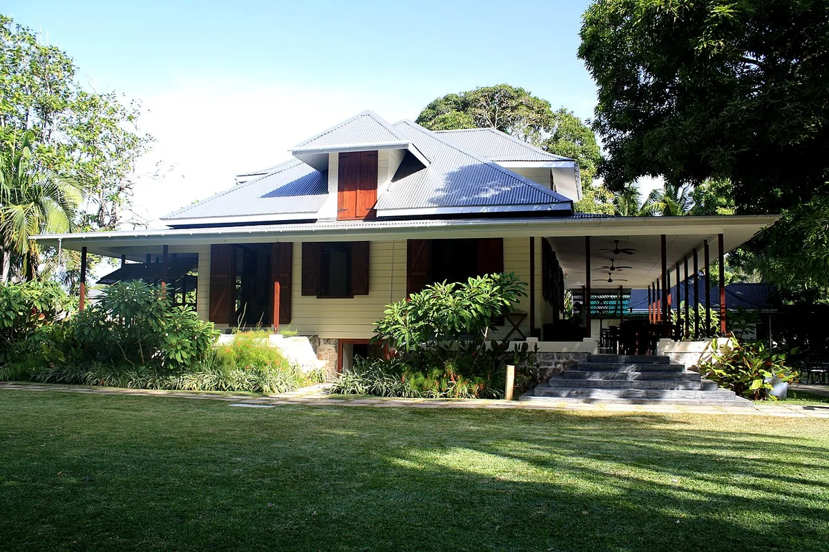

Takamaka rum is made at La Plaine St André near Au Cap, a plantation estate whose house dates from 1792. On weekdays a short tour walks you through cane, fermentation, the stills and the barrels, followed by a tasting of six rums. The garden, shop and restaurant also open at weekends, when production stops. It holds about 2,500 Google reviews at 4.6.
★ 4.6 from 2,529 Google reviews (checked 10 November 2026) · Read the Google reviews
- Type
- Rum distillery
- Time to allow
- 30 minutes to 1.5 hours
- Entrance
- Tour free, tasting SCR 150 (about €9)
- Tasting
- 6 rums SCR 150, 2 premium rums SCR 100 more
- Production
- Weekdays only
- Age
- No alcohol under 18
Local tip: Want to see the stills working? Go on a weekday. Bottles go in checked luggage. All entrance fees.
Tours that stop here: Mahé island tour, private
Sources: Island Tour Seychelles, SeyBooking.com entrance fees fact sheet, Google Maps
GPS -4.7194, 55.5231 · Back to the map
22 Anse Takamaka
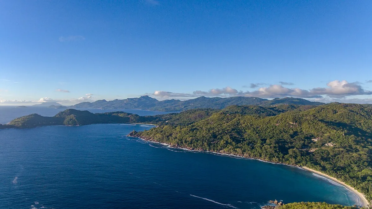

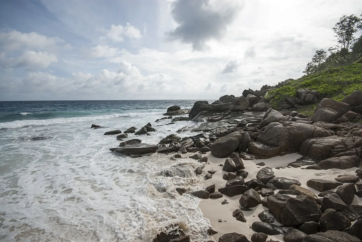
Anse Takamaka is a long sandy beach on the south coast, named after the takamaka trees whose roots run down into the sand. There is shade all day, a restaurant, a small shop and toilets, which makes it a natural lunch and swim stop. It faces south-west: calm from December to March, and swell with currents in the trade wind months.
★ 4.6 from 917 Google reviews (checked 10 November 2026) · Read the Google reviews
- Type
- Beach
- Time to allow
- 1 hour
- Swimming
- Calm December to March, swell May to September
- Entrance
- Free
- Facing
- South-west
- Facilities
- Restaurant, shop, toilets, all-day shade
- Lifeguards
- None
Local tip: Late afternoon is the prettiest time, when the beach empties and the trees throw long shadows.
Tours that stop here: Mahé island tour, private · Mahé beach tour, private
Sources: Island Tour Seychelles, Google Maps
GPS -4.7760, 55.4945 · Back to the map
23 Anse Intendance
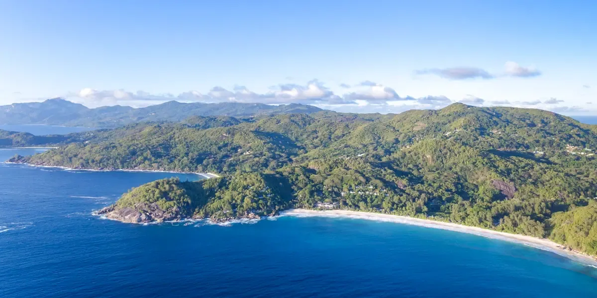
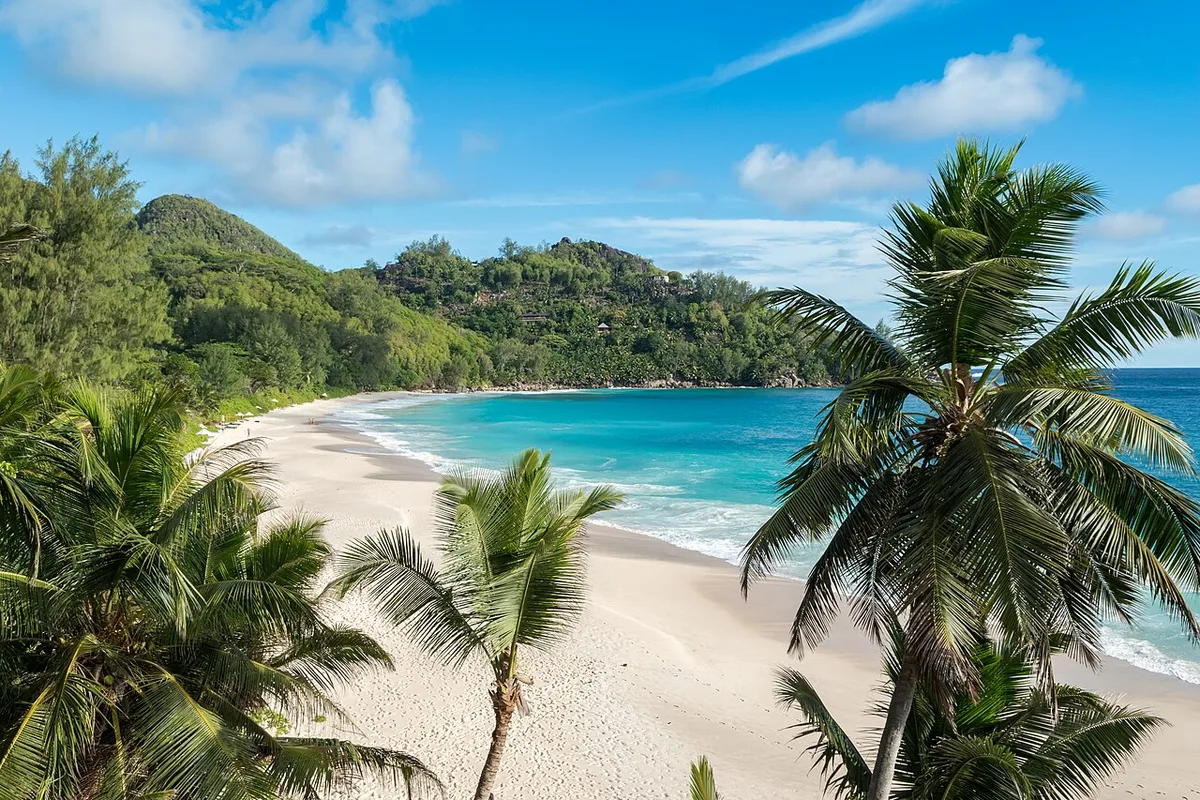
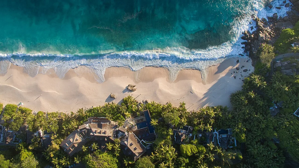
Anse Intendance is the wide, wild curve of sand on Mahé's south coast that many visitors picture when they think of Seychelles. There is no reef in front, so the swell arrives unbroken, and currents can pull sideways and out. From December to March it is often calm. Hawksbill turtles nest here, mostly from October to February.
★ 4.7 from 1,069 Google reviews (checked 10 November 2026) · Read the Google reviews
- Type
- Wild surf beach
- Time to allow
- 30 minutes to 1 hour
- Swimming
- Often unsafe: no reef, strong swell and currents May to September
- Entrance
- Free
- Reef
- None, open ocean
- Turtles
- Nesting mostly October to February
- Facilities
- None on the beach, bring water
- Access
- Narrow steep road from the south road
Local tip: If you see tracks that look like a small tractor, a turtle came ashore at night. Keep your distance and never dig.
Tours that stop here: Mahé island tour, private · Mahé beach tour, private
Sources: Island Tour Seychelles, Wikipedia, Google Maps
GPS -4.7840, 55.4993 · Back to the map
24 Anse Bazarca
Anse Bazarca is a small, steep cove on the south coast between Anse Intendance and Police Bay, reached by a short path through the trees. Big granite slabs and rolling surf make it a photographer's beach rather than a swimmer's. It has very few visitors, and a near perfect 4.9 rating from the few who leave Google reviews.
★ 4.9 from 9 Google reviews (checked 10 November 2026) · Read the Google reviews
- Type
- Hidden cove
- Time to allow
- 30 minutes
- Swimming
- No: strong surf and currents
- Entrance
- Free
- Access
- Short path from the south road, steep at the end
- Swimming
- Not advised
- Facilities
- None
Local tip: Go with someone who knows the path. Do not go in the water in any season.
Tours that stop here: Mahé beach tour, private
Sources: Google Maps, OpenStreetMap
GPS -4.8012, 55.5126 · Back to the map
25 Police Bay

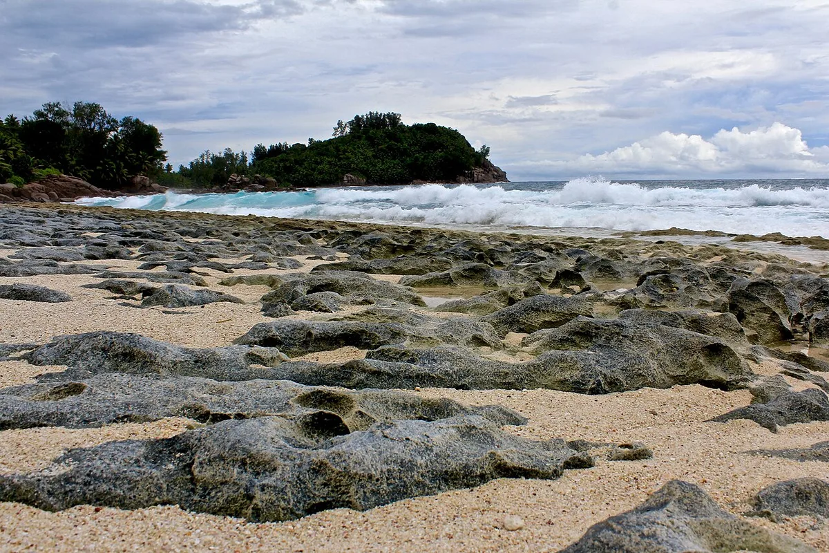
Police Bay is the beach at the southern tip of Mahé, at the end of the road past Quatre Bornes. Waves roll in from the open ocean onto a long empty strand backed by granite and forest. It is one of the most dramatic sights on the island, and one of the most dangerous for swimming. Look, walk and photograph, but do not swim.
★ 4.7 from 431 Google reviews (checked 10 November 2026) · Read the Google reviews
- Type
- Viewpoint beach
- Time to allow
- 20 to 40 minutes
- Swimming
- No: dangerous currents and heavy surf
- Entrance
- Free
- Where
- Southern tip of Mahé
- Swimming
- Never
- Facilities
- None
Local tip: Late afternoon light is beautiful here. Leave before dark, as the road back is narrow.
Tours that stop here: Mahé beach tour, private · Mahé island tour, private
Sources: Google Maps, OpenStreetMap
GPS -4.8027, 55.5218 · Back to the map
The southwest: small bays below Baie Lazare
Where Mahé's recorded history starts, and the turn-off to the small, sheltered coves locals send you to for snorkelling and sunsets.
26 Baie Lazare


Baie Lazare in the south-west is named after Lazare Picault, the French explorer who anchored here in 1742 and first charted Mahé. The long, flat beach is often almost empty. Above it stands the stone church of St Francis of Assisi with a view over the whole bay. Behind the village is the turn-off to Anse Soleil and Petite Anse.
★ 4.7 from 464 Google reviews (checked 10 November 2026) · Read the Google reviews
- Type
- Bay and village
- Time to allow
- 20 minutes to 1 hour
- Swimming
- Possible, with surf when windy
- Entrance
- Free
- History
- Lazare Picault, 1742
- Church
- St Francis of Assisi, on the hill
- Food
- Village shops, hotel terraces on the bay
Local tip: Stop at the church square for the classic view of the bay, then head to the small coves.
Tours that stop here: Mahé beach tour, private · Mahé island tour, private
Sources: Island Tour Seychelles, Wikipedia, Google Maps
GPS -4.7595, 55.4844 · Back to the map
27 Anse Soleil
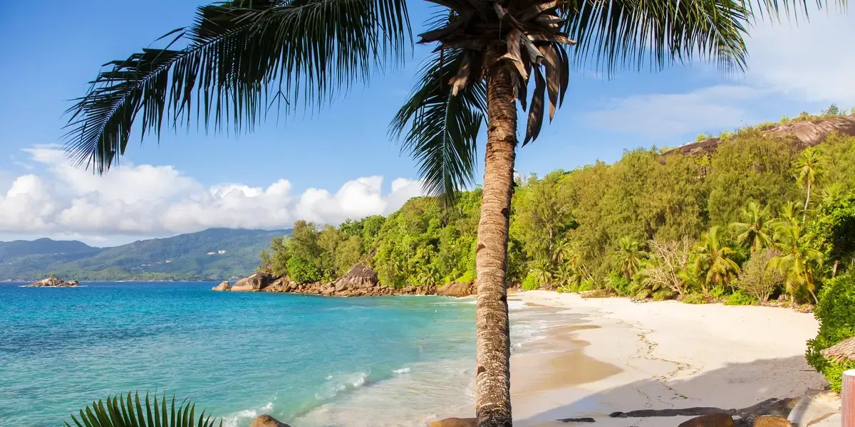
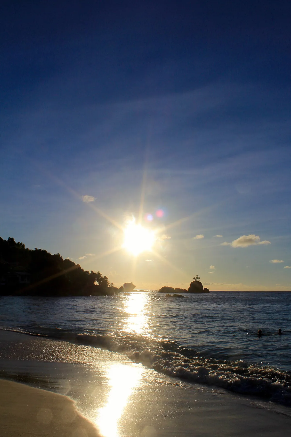
Anse Soleil is a small, sheltered cove on the south-west coast below Baie Lazare, framed by granite on both sides. Fish gather around the rocks at each end, so it is one of the easiest snorkelling beaches on Mahé, with a sandy entry and no fins needed. A small café on the sand serves Creole food. It rates 4.8 on Google from over 600 reviews.
★ 4.8 from 612 Google reviews (checked 10 November 2026) · Read the Google reviews
- Type
- Sheltered cove
- Time to allow
- 1 to 2 hours
- Swimming
- Yes, calm, good snorkelling by the rocks
- Entrance
- Free
- Facing
- West
- Facilities
- Café and toilets
- Road
- Narrow and steep at the end
Local tip: The last stretch is a tight, steep lane with two-way traffic. Not ideal on your first day in a rental car.
Tours that stop here: Mahé beach tour, private
Sources: Island Tour Seychelles, Google Maps
GPS -4.7450, 55.4659 · Back to the map
28 Petite Anse
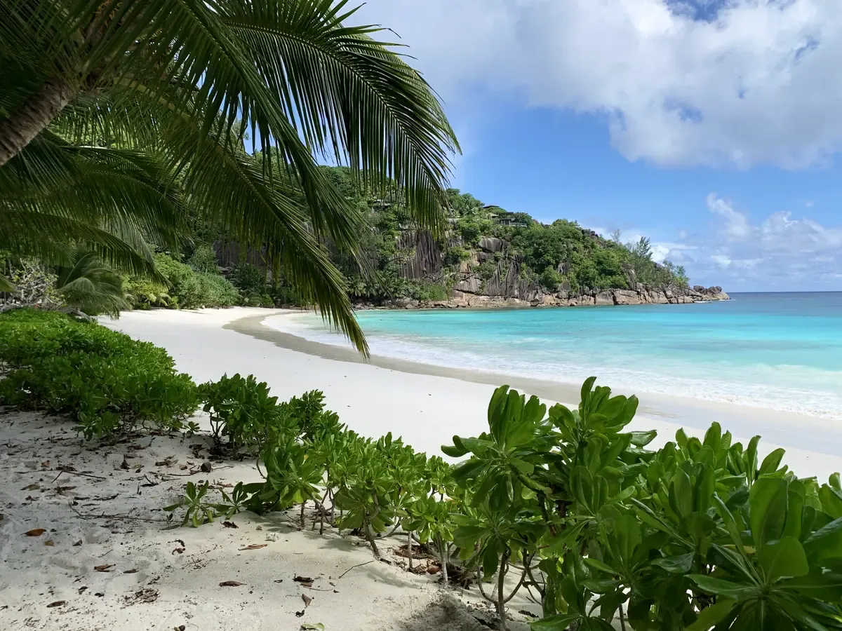
Despite the name, Petite Anse is a wide curve of white sand between two rocky headlands near Baie Lazare, hidden below the hill and the Four Seasons resort. Beaches in Seychelles are public. Access is through the resort road, and staff at the gate let beach visitors through. There is no shop and little shade, so it stays quiet.
★ 4.7 from 616 Google reviews (checked 10 November 2026) · Read the Google reviews
- Type
- Beach
- Time to allow
- 1 hour
- Swimming
- Calm December to April, swell May to September
- Entrance
- Free
- Access
- Resort road, beach is public
- Facilities
- None for the public, bring water
- Rating
- 4.7 on Google
Local tip: Say you are going to the beach at the gate. Go in the calm months for clear water.
Tours that stop here: Mahé beach tour, private
Sources: Island Tour Seychelles, Google Maps
GPS -4.7540, 55.4650 · Back to the map
29 Anse à la Mouche


Anse à la Mouche is a wide, very shallow bay on the west coast between Baie Lazare and Anse Boileau. You can walk a long way out and still stand, so it suits small children and paddlers more than swimmers. It faces west, and on calm evenings the sky reflects in the water: one of the best sunset spots on Mahé.
★ 4.4 from 107 Google reviews (checked 10 November 2026) · Read the Google reviews
- Type
- Shallow lagoon
- Time to allow
- 30 minutes to 1 hour
- Swimming
- Very shallow, ideal for small children
- Entrance
- Free
- Depth
- Very shallow, protected by the reef
- Activities
- Kayak and paddleboard hire nearby
- Food
- Restaurants along the road
Local tip: Come at sunset, when the water is mirror-flat.
Tours that stop here: Mahé beach tour, private
Sources: Island Tour Seychelles, Google Maps
GPS -4.7330, 55.4835 · Back to the map
30 Anse Louis
Anse Louis is a secluded bay on the west coast between Anse à la Mouche and Anse Boileau, below the MAIA Luxury Resort. The beach is public, but there is no public car park, so most visitors see it from the road or the sea. It rates 4.6 on Google.
★ 4.6 from 105 Google reviews (checked 10 November 2026) · Read the Google reviews
- Type
- Bay
- Time to allow
- 10 to 20 minutes
- Swimming
- Yes in calm weather
- Entrance
- Free
- Facing
- West
- Access
- Limited, no public parking
Local tip: A short photo stop on the west coast drive. For a swim, go on to Anse Boileau or Anse à la Mouche.
Tours that stop here: Mahé beach tour, private
Sources: Google Maps, OpenStreetMap
GPS -4.7195, 55.4801 · Back to the map
The west coast: Port Glaud to Baie Ternay
A waterfall, a lagoon, a tidal islet and two marine parks. West-facing, so the sunsets are here. Calm from December to March.
31 Grand Anse (Mahé)
Grand Anse is the longest beach on Mahé's west coast, a sweep of sand between Anse Boileau and Port Glaud with surf rolling in from the open sea. It is magnificent for a walk, but there are strong currents and no lifeguards, so locals do not swim here. Inland, the National Biodiversity Centre at Barbarons is a short drive away.
★ 4.5 from 211 Google reviews (checked 10 November 2026) · Read the Google reviews
- Type
- Long wild beach
- Time to allow
- 20 to 40 minutes
- Swimming
- Not advised: strong currents most of the year
- Entrance
- Free
- Swimming
- Not advised
- Nearby
- National Biodiversity Centre, Barbarons, SCR 150
- Facilities
- Few
Local tip: Walk it at low tide for the widest stretch of sand.
Tours that stop here: Mahé island tour, private
Sources: Google Maps, SeyBooking.com entrance fees fact sheet
GPS -4.6777, 55.4481 · Back to the map
32 Anse Trusalo and L'Islette
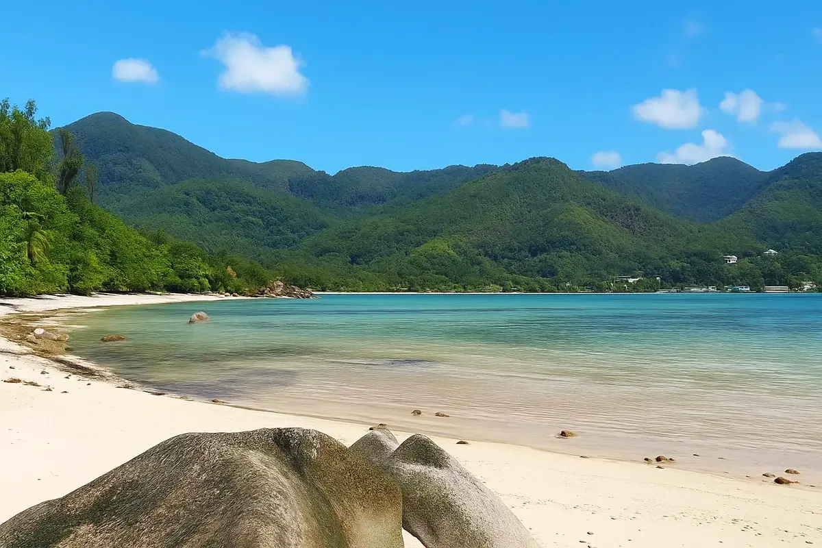


Anse Trusalo is a quiet west-coast beach near Port Glaud, about 300 to 400 m of soft sand with no buildings, facing the small island of L'Islette. At low tide you can sometimes wade across to L'Islette. The tide also decides the way in and out, so check tide times before you stay late. The Port Glaud lagoon and mangroves are close by.
★ 4.3 from 31 Google reviews (checked 10 November 2026) · Read the Google reviews
- Type
- Quiet beach and tidal islet
- Time to allow
- 1 to 2 hours
- Swimming
- Yes, gentle slope, mind the tide
- Entrance
- Free
- Length
- About 300 to 400 m
- Facilities
- None
- From Victoria
- About 17 km, 30 minutes over the Sans Souci road
Local tip: Check tide times before you go, and do not get cut off on L'Islette as the water rises.
Tours that stop here: Mahé beach tour, private · Ros Lepa hike, private
Sources: Island Tour Seychelles, Google Maps
GPS -4.6620, 55.4036 · Back to the map
33 Sauzier Waterfall

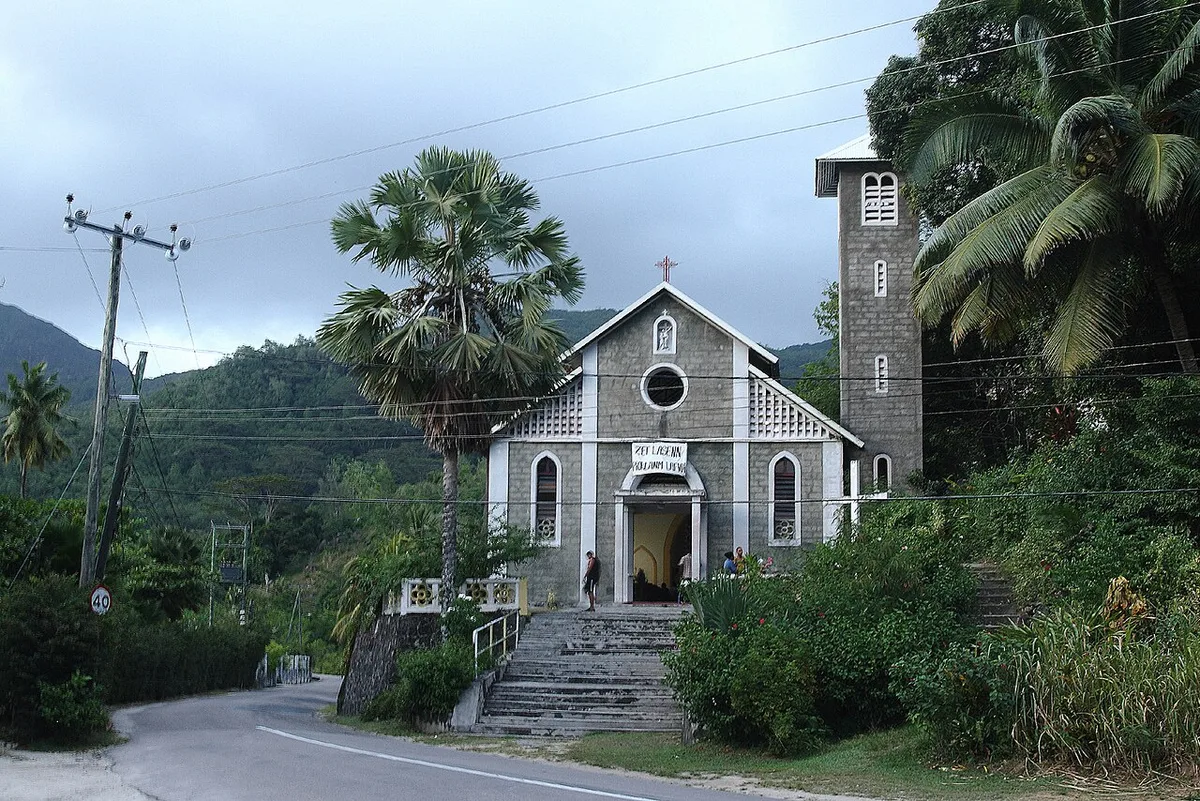
The Sauzier Waterfall drops into a fresh-water pool in the forest just above Port Glaud. It is a short, damp, slippery walk from the village, and after a morning on the beaches a swim in cool water is the surprise of the day. Access crosses private land, so there is a small entrance fee, paid in cash at the booth.
★ 4.1 from 678 Google reviews (checked 10 November 2026) · Read the Google reviews
- Type
- Waterfall
- Time to allow
- 30 minutes to 1 hour
- Swimming
- Yes, cool fresh-water pool, rocky bottom
- Entrance
- SCR 50 (about €3), SCR 25 age 6 to 11
- Hours
- 9:00 to 16:00 weekdays, 9:30 to 16:00 weekends
- Shoes
- Grippy, the stones are slippery
Local tip: Best after rain, when the fall is full. Wear shoes you can get wet. All entrance fees.
Tours that stop here: Mahé island tour, private · Mahé beach tour, private
Sources: Island Tour Seychelles, SeyBooking.com entrance fees fact sheet, Google Maps
GPS -4.6584, 55.4147 · Back to the map
34 Port Launay

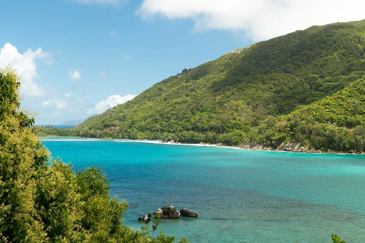
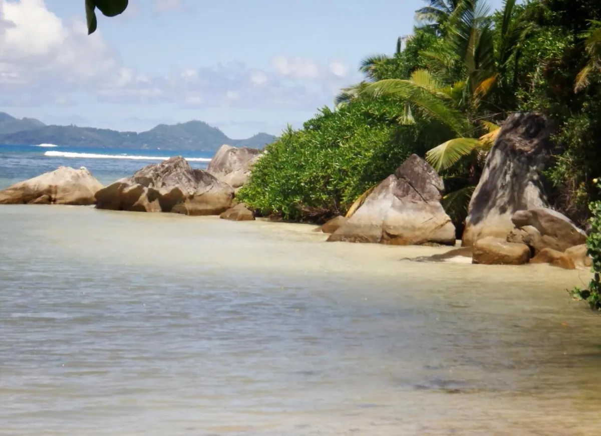
Port Launay is a sheltered bay at the north end of the west coast road, inside the Port Launay Marine National Park. Casuarina trees shade the sand almost to the water, the entry is shallow and sandy, and the rocks at each end are good for snorkelling because the reef is protected. It is quiet on weekdays and busy with family barbecues at weekends.
★ 4.6 from 1,337 Google reviews (checked 10 November 2026) · Read the Google reviews
- Type
- Beach in a marine park
- Time to allow
- 20 minutes to 1 hour
- Swimming
- Yes, calm and shallow, snorkelling by the rocks
- Entrance
- Free on the beach
- Protection
- Marine national park, no fish feeding, no touching coral
- Facilities
- Toilets and a snack bar nearby
- Bus
- End of the west coast line
Local tip: Allow a full hour if you want to snorkel. It is one of the best value swims on Mahé.
Tours that stop here: Mahé island tour, private · Mahé beach tour, private
Sources: Island Tour Seychelles, Seychelles Parks and Gardens Authority, ticket list, Google Maps
GPS -4.6532, 55.4000 · Back to the map
35 Baie Ternay Marine National Park

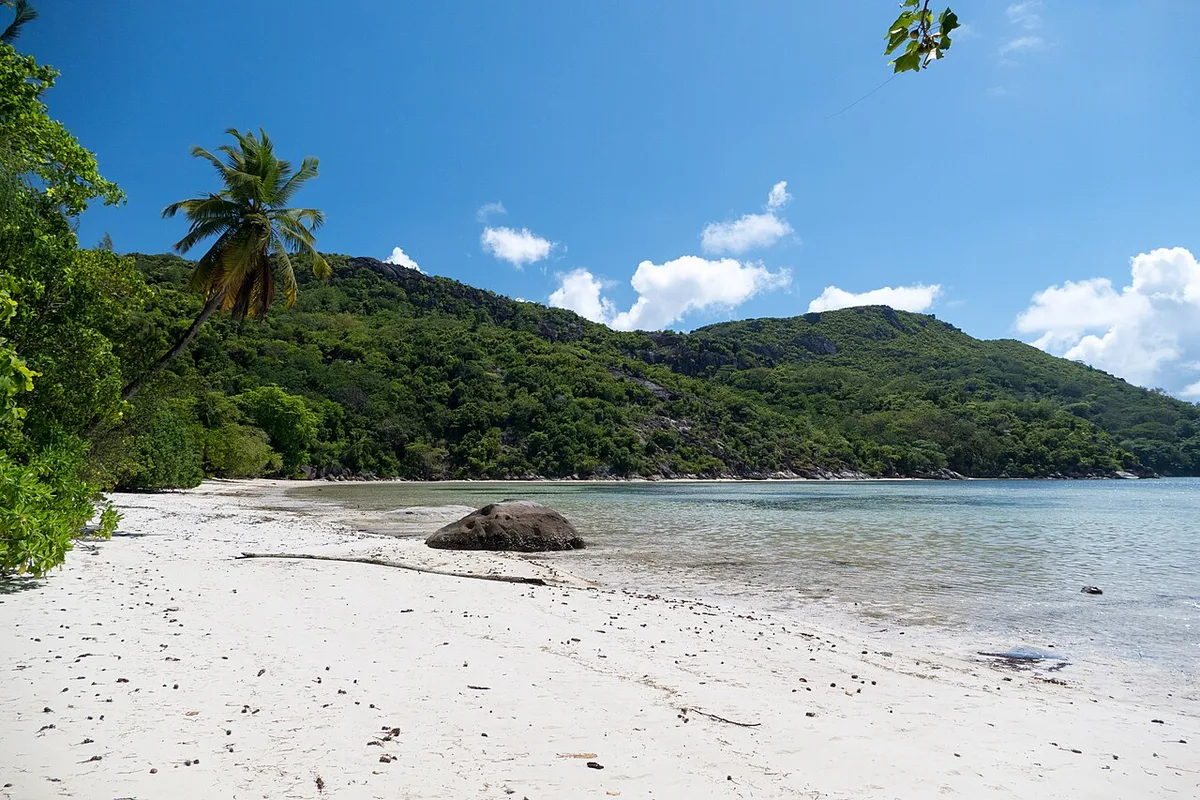
Baie Ternay Marine National Park is a deep, sheltered bay at the north-west tip of Mahé, protected together with Port Launay. There is no public road, so most people come by boat for some of the best snorkelling around Mahé: reef fish, turtles and sometimes rays in clear water.
★ 4.7 from 136 Google reviews (checked 10 November 2026) · Read the Google reviews
- Type
- Marine national park
- Time to allow
- Half day by boat
- Swimming
- Yes, snorkelling over protected reef
- Entrance
- SCR 200 (about €12), age 12+
- Access
- By boat
- Hours
- 8:00 to 17:00
Local tip: Combine it with Anse Major on a boat day. Ask whether the park fee is included. All entrance fees.
Tours that stop here: Baie Ternay and Anse Major by boat
Sources: Seychelles Parks and Gardens Authority, ticket list, SeyBooking.com entrance fees fact sheet, Google Maps
GPS -4.6387, 55.3738 · Back to the map
36 Anse Boileau

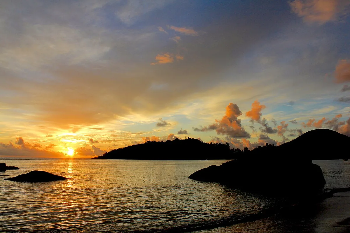
Anse Boileau is a long bay and village on the west coast, between Anse à la Mouche and Grand Anse. It is a working village rather than a resort beach, with local restaurants, shops and fishing boats. It is a good place to stop for a Creole lunch on a west coast drive.
★ 4.4 from 149 Google reviews (checked 10 November 2026) · Read the Google reviews
- Type
- Village bay
- Time to allow
- 30 minutes to 1 hour
- Swimming
- Calm December to April
- Entrance
- Free
- Facing
- West
- Food
- Local restaurants along the road
- Bus
- West coast line
Local tip: Stay for the sunset if you are already on this side of the island.
Tours that stop here: Mahé island tour, private
Sources: Google Maps
GPS -4.7117, 55.4822 · Back to the map
The mountains: Sans Souci road and the national park
About a fifth of Mahé is national park. The Sans Souci road crosses it past the tea plantation, the Mission Lodge ruins and the start of the main trails.
37 Morne Seychellois National Park
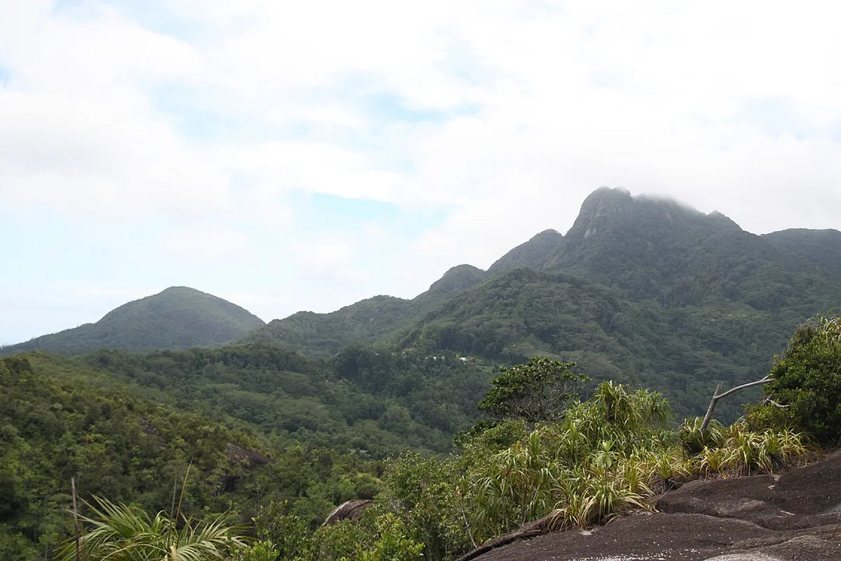


Morne Seychellois National Park covers about a fifth of Mahé, roughly 3,045 hectares of mountain forest and granite. It includes Morne Seychellois, at 905 m the highest point in Seychelles. Cloud forms on the ridge most days, so the park is cool and green, with endemic palms, pitcher plants and birds found nowhere else. Its marked trails range from easy Copolia to the guided-only summit.
★ 4.7 from 173 Google reviews (checked 10 November 2026) · Read the Google reviews
- Type
- National park
- Time to allow
- Hours to a full day
- Entrance
- Trail fees SCR 100 to 250, age 12+
- Highest point
- Morne Seychellois, 905 m
- Summit trail
- SCR 250, licensed guide required, 8:00 to 12:00
- Pay
- Card only on site or online
Local tip: Start between 7:00 and 9:00. From 11:00 every climb gets hot, and cloud often hides the view. All entrance fees.
Tours that stop here: Copolia hike, private · Morne Blanc hike, private · Trois Frères hike, private · Dans Gallas hike, private · Gorilla rock hike, private
Sources: Island Tour Seychelles, Seychelles Parks and Gardens Authority, ticket list, Wikipedia, SeyBooking.com entrance fees fact sheet
GPS -4.6489, 55.4195 · Back to the map
38 Sans Souci tea factory
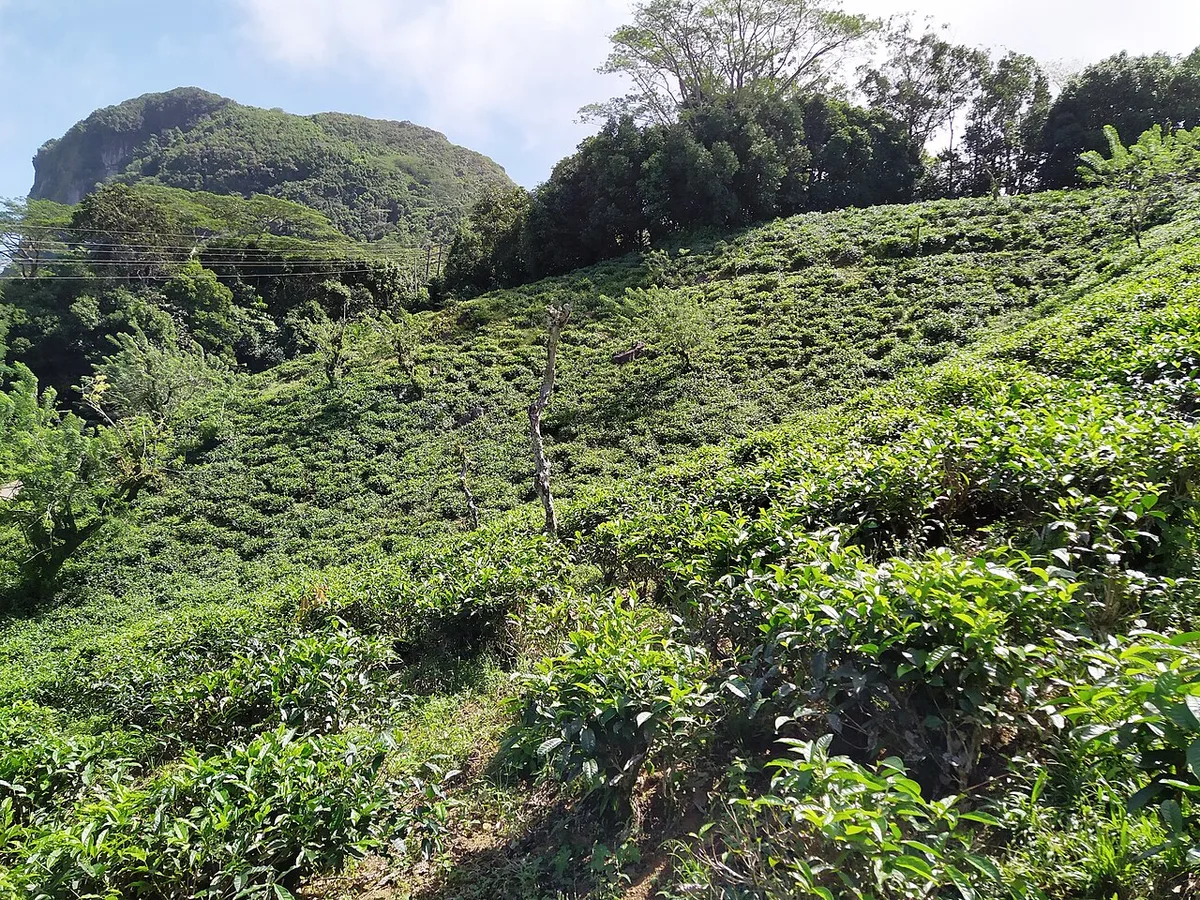
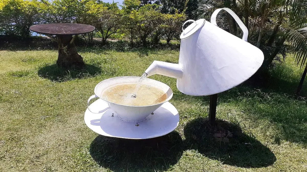
Seychelles grows its own tea on the Sans Souci road, at around 400 m above Port Glaud. The small factory runs a short weekday tour showing how leaves are withered, rolled, fermented and dried, and its shop sells vanilla, cinnamon and lemongrass tea. The terrace looks down over the west coast to Port Launay and, on clear days, Silhouette.
★ 4.0 from 47 Google reviews (checked 10 November 2026) · Read the Google reviews
- Type
- Tea factory and viewpoint
- Time to allow
- 20 to 40 minutes
- Entrance
- Tour SCR 25 to 35 (about €2)
- Tour
- About 20 minutes, weekdays, mornings most reliable
- Buy
- Vanilla tea, light and actually made here
- Next door
- The Morne Blanc trail starts nearby
Local tip: It can be closed at weekends. Ask your guide to phone ahead. All entrance fees.
Tours that stop here: Mahé island tour, private · Morne Blanc hike, private
Sources: Island Tour Seychelles, Seychelles Tourism Board, SeyBooking.com entrance fees fact sheet, Google Maps
GPS -4.6631, 55.4384 · Back to the map
39 Mission Lodge (Venn's Town)


Mission Lodge, properly Venn's Town, sits at about 500 m on the Sans Souci road. From 1875 to 1889 a mission school here taught the children of Africans freed from slave ships by the British navy. Today an avenue of trees leads past the ruined walls to a pavilion, built for Queen Elizabeth II's visit in 1972, with one of the widest views on Mahé.
★ 4.4 from 355 Google reviews (checked 10 November 2026) · Read the Google reviews
- Type
- Viewpoint and ruins
- Time to allow
- 10 to 20 minutes
- Entrance
- SCR 100 (about €6), under 12 free
- History
- School for freed African children, 1875 to 1889
- Weather
- Cooler and often misty, bring a layer
Local tip: Ten minutes at the pavilion shows you how steep and small Mahé really is. All entrance fees.
Tours that stop here: Mahé island tour, private
Sources: Island Tour Seychelles, SeyBooking.com entrance fees fact sheet, Google Maps
GPS -4.6552, 55.4443 · Back to the map
40 Copolia
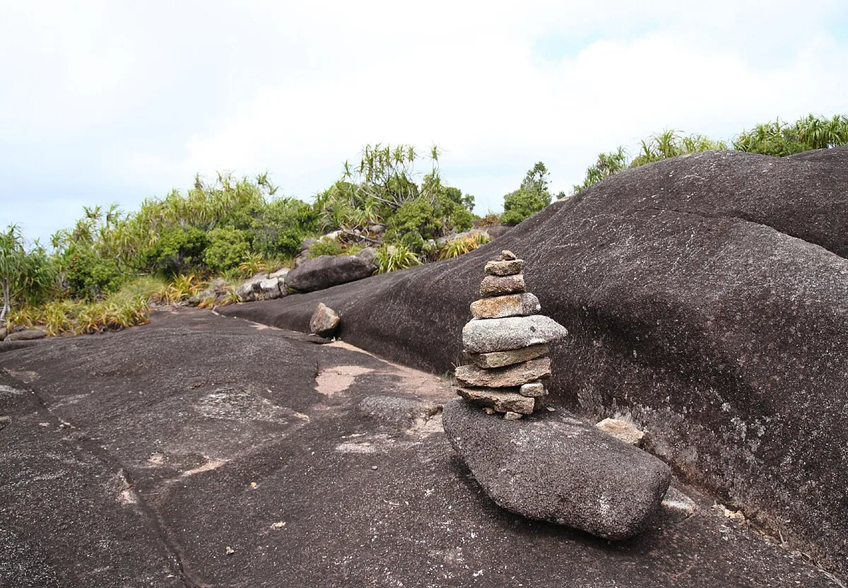
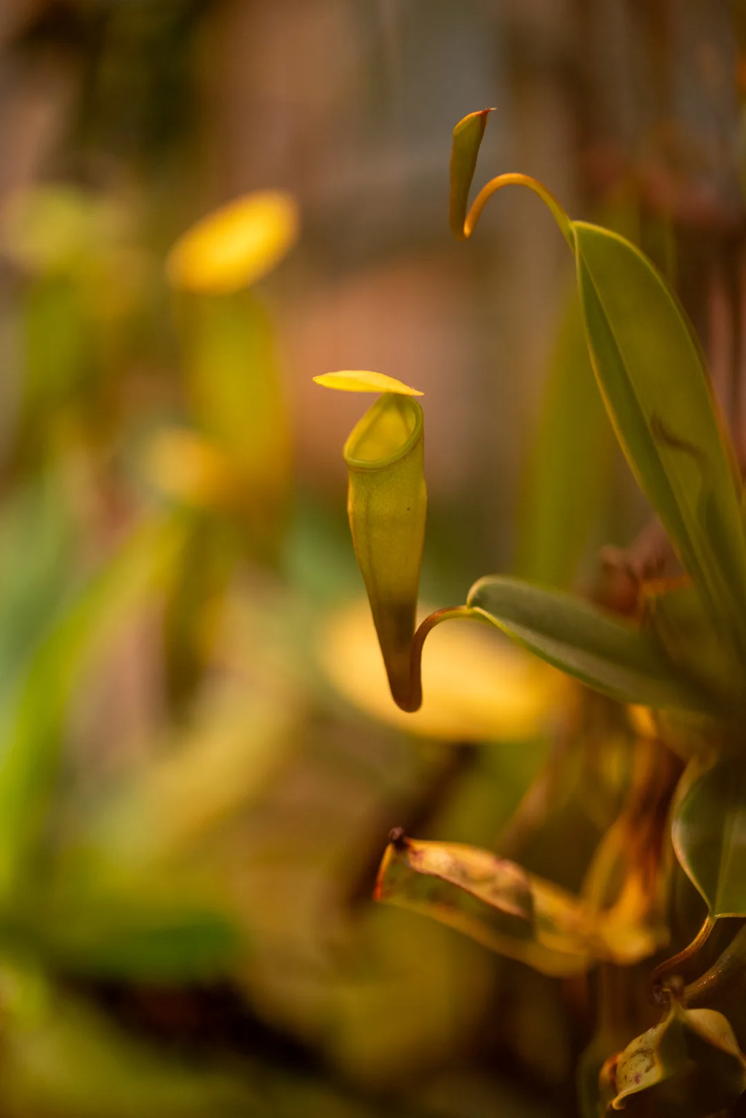
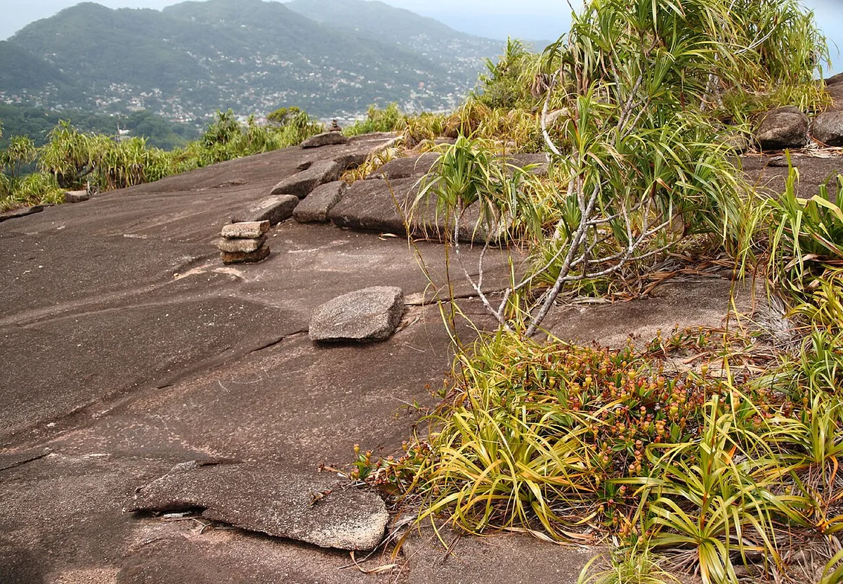
Copolia is the best known short hike on Mahé: a shaded trail of a little under an hour up to a bare granite dome at 497 m. From the top you look over Victoria, Eden Island, the Ste Anne islands and the airport. Seychelles pitcher plants, which grow wild only on Mahé and Silhouette, cling to the rocks near the summit. It holds over 900 Google reviews at 4.8.
★ 4.8 from 938 Google reviews (checked 10 November 2026) · Read the Google reviews
- Type
- Short summit hike
- Time to allow
- 2 hours on the trail
- Entrance
- SCR 100 (about €6), age 12+
- Summit
- 497 m
- Level
- Easy, from age 5
Local tip: Look down as well as out. The pitcher plants sit low on the rocks near the top. All entrance fees.
Tours that stop here: Copolia hike, private
Sources: Seychelles Parks and Gardens Authority, ticket list, OpenStreetMap, Google Maps, SeyBooking.com entrance fees fact sheet
GPS -4.6470, 55.4528 · Back to the map
41 Morne Blanc


The Morne Blanc trail climbs steeply from the Sans Souci road near the tea factory through cool mist forest to a wooden platform on a cliff edge at about 675 m. The view drops straight to the west coast. It is short, steep and rooty, and one of the most photographed views in Seychelles, with over 700 Google reviews at 4.8.
★ 4.8 from 720 Google reviews (checked 10 November 2026) · Read the Google reviews
- Type
- Steep forest hike
- Time to allow
- 2 to 3 hours on the trail
- Entrance
- No trail fee on the government list
- Top
- Platform at about 675 m
- Level
- Short but steep, from age 8
- Clouds
- Often in mist by midday
Local tip: Go early. Clear views are most likely before 10:00.
Tours that stop here: Morne Blanc hike, private
Sources: OpenStreetMap, Google Maps, Seychelles Parks and Gardens Authority, ticket list
GPS -4.6605, 55.4375 · Back to the map
42 Trois Frères

Trois Frères, the three brothers, are the granite peaks that tower over Victoria. The trail from the Sans Souci road is steep in places and rocky near the top, and ends at a viewpoint over the capital, the port and the Ste Anne islands. It is far quieter than Copolia.
★ 4.4 from 43 Google reviews (checked 10 November 2026) · Read the Google reviews
- Type
- Summit hike above Victoria
- Time to allow
- 2.5 to 3.5 hours on the trail
- Entrance
- SCR 150 (about €9), age 12+
- Level
- Moderate to hard
- Start
- Sans Souci road
Local tip: Take two litres of water each. The top section is exposed. All entrance fees.
Tours that stop here: Trois Frères hike, private
Sources: Seychelles Parks and Gardens Authority, ticket list, Google Maps, SeyBooking.com entrance fees fact sheet
GPS -4.6408, 55.4519 · Back to the map
43 Vallée des Fruits

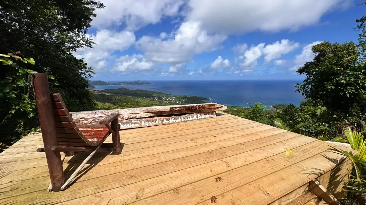

Vallée des Fruits is an organic fruit garden in the hills inland from the east coast, close to the airport. Easy paths lead past tropical fruit trees to viewpoints and a small waterfall, and visits end with a fruit platter and fresh juice or a coconut. It rates 4.8 on Google from nearly 500 reviews, and it fits well into a long wait before a flight.
★ 4.8 from 484 Google reviews (checked 10 November 2026) · Read the Google reviews
- Type
- Organic fruit garden
- Time to allow
- 1 to 1.5 hours
- Entrance
- Paid on site, or included on the airport tour
- Near
- Seychelles International Airport
- Facilities
- Toilets at the entrance, garden bar
- Good for
- Early arrivals and late departures
Local tip: On the airport tour your luggage stays locked in the vehicle while you visit.
Tours that stop here: Airport tour, Vallée des Fruits
Sources: Island Tour Seychelles, Google Maps
GPS -4.6730, 55.4619 · Back to the map
Which coast is calm when
| Months | Wind | Calm side | Rough side |
|---|---|---|---|
| May to October | South-east trade wind | North-west: Beau Vallon, Sunset Beach, north coast | South and east: Anse Intendance, Takamaka, seagrass at Anse Royale |
| December to March | North-west monsoon | South and west: Anse Intendance, Takamaka, Petite Anse, Anse Soleil | North-west: Beau Vallon gets swell |
| April and November | Changeover, light winds | Usually calm all round | None in particular |
Wherever you are, there are no lifeguards on most Mahé beaches. If the water looks rough, it is.
Mahé attractions: questions people ask
What are the best attractions on Mahé?
Beau Vallon and Anse Intendance for beaches, Anse Soleil and the Ste Anne Marine Park for snorkelling, the Copolia and Morne Blanc trails for views, and Victoria's market, Clock Tower and Botanical Garden for culture. Among the 43 places in this guide, the most-reviewed on Google are the Takamaka Rum Distillery, the Sir Selwyn Selwyn-Clarke Market and the Botanical Garden.
How many days do I need on Mahé?
Two or three days cover the highlights: one for Victoria and the east and south coasts, one for the west coast and the Sans Souci road, and one for a hike or a marine park trip. A private island tour fits the main stops into 5 to 6 hours.
Which Mahé beaches are safe for swimming?
The reef-protected beaches are the calmest: Anse Royale, Anse Forbans, Port Launay, Anse à la Mouche and, from May to October, Beau Vallon. Do not swim at Police Bay, Anse Bazarca, Carana Beach or Grand Anse. Anse Intendance is only safe on calm days, mostly December to March.
Which side of Mahé is calm in which month?
From May to October the south-east trade wind makes the south and east coasts choppy, and the north-west, including Beau Vallon, is calm. From December to March the north-west monsoon reverses it: the south and west are calm and Beau Vallon gets swell. April and November are usually calm all round.
Do Mahé attractions charge an entrance fee?
Beaches, Victoria and the market are free. Government sites charge visitors aged 12 and over, card only on site: Botanical Garden SCR 250, Copolia trail SCR 100, Anse Major and Trois Frères trails SCR 150, Ste Anne and Baie Ternay marine parks SCR 200. Private sites set their own fees, such as the Sauzier Waterfall at SCR 50. All fees are on our entrance fees page.
Can I visit Mahé attractions by bus?
Yes for most of the coast. Buses from Victoria reach Beau Vallon, Anse Royale, Takamaka, Port Glaud and Port Launay. The Sans Souci road, the small south-west coves and Anse Intendance are hard to reach by bus. A rental car or a private tour with pick-up is easier there.
Is it worth hiring a guide on Mahé?
For the beaches and Victoria you can manage alone. Guides earn their fee on the mountain trails, which are unsigned beyond Copolia and Morne Blanc, have no phone signal and are slippery after rain, and on the narrow roads to Anse Soleil and Petite Anse. The Morne Seychellois summit trail needs a licensed guide by law.
Where do the Google ratings on this page come from?
From each place's Google Maps listing, read on 10 November 2026. We show the score and number of reviews and link to the reviews on Google. Some places, such as the Bel Ombre treasure site and Bazar Labrin, have no rated listing.
Sources and method
- Island Tour Seychelles, the licensed Mahé operator, place articles read 10 November 2026 (facts reworded and checked).
- Seychelles Parks and Gardens Authority, ticket list and visitor information, for park, trail and marine park fees.
- Seychelles Tourism Board attraction pages, and Wikipedia for history and dates.
- Google Maps listings for ratings, review counts and pin positions, read 10 November 2026. OpenStreetMap for heights and the map.
- Photos: Island Tour Seychelles (with permission) and Wikimedia Commons under open licences, credited under each photo.
- Euro amounts use SCR 16.2 to €1 and are rounded. Fees change: see the entrance fees page for the latest we have checked.
See it with a local guide. The private Mahé island tour and the beach tour include free pick-up anywhere on Mahé, and you choose the stops. For the mountains, try Copolia or Morne Blanc.